Home > Indian History > Geography of India > Geography of Berhampur
Geography of Berhampur
Berhampur also spelt, as Brahmapur is one of the largest cities of Orissa.

Share this Article:

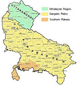
Berhampur, Orissa is a significant city in the whole of Indian continent. It also can be spelt as Brahmapur. It is one of the ancient most and also the largest city of Orissa. To all the people of the country it is popularized as the Silk City due to its treasures of silk, exquisite temples and also the commercial capital of the city. Before venturing into the city, it becomes inevitable on the part of a tourist enthusiast to get acquainted with geography of Berhampur, Orissa. It lies in the east coast line of the state. Berhampur lies approximately at 19.32|N| and 84.78|E|. It rises to height of 27 meters or 88 feet above the mean sea level.

Demographic details help one to identify the geography of Berhampore. A special mentioning may be made of the Census report, which has been issued forth in the year 2001. It is a vital document which depicts facts like literacy rate, population status etc. As per this report, the city of Berhampur, Orissa has shown a total population counting of 307,724. Out of it, male population constitutes 52 %. In comparison female populace is less and thus comprises of 48 % only. Children who are below six years of age constitute 11 % of the total population. Experts say that it is the 3rd most populated one urban region of the state.

Literacy rate too acts as vital information about Berhampore`s demography. According to this report, its average literacy rate constitutes 74 %, which is even higher than that of the entire nation, which measures 59.5 %. To be specific, male literacy rate is 83 %, while the rate of female literacy is 64 %.

Water bodies are found which proves that geography of Berhampur, Orissa is quite an improved one. Lying about thirty kilometers from Berhampur, exquisite beach at Aryapalli is calm and appealing with swapping waves washing into the shores. Its serene climate invigorates any tourist and adds newness to his life. In the lap of Mother Nature one basks into the sun light, enjoy surfing, play with the sands and feels to be at the top of the world.


Share this Article:

Related Articles

More Articles in Geography of India


Geography of Uttar Pradesh
The fourth largest State in India UP is located in the Northern part of India whose area is 2,36,286 sq Kms.
Geography of Maharashtra
Covering an area of 308,000 sq. km, Maharashtra, the third largest state in India.
Geography of Kerala
Geography of Kerala includes plains, hills, valleys and coasts. With the Arabian Sea in the west, the Western Ghats in the east and networked by several rivers, Kerala enjoys diverse geographical features.
Geography of West Bengal
The geography of West Bengal is unique with high peaks of the Himalayan range in the north, the Bay of Bengal in the south and the remaining region is covered with both plains and plateaus.
Geography of Jharkhand
Geography of Jharkhand is comprised of the rich mineral resources and the highly agricultural prospect in this state.
Geography of Sikkim
Geography of Sikkim is characterised by a vast array of magnificent hillock that extends from one corner of the state to the other.
Geography of Meghalaya
The suitable climate, highland plateaus, rivers and the flora and fauna together forms the geography of Meghalaya.
Geography of Mizoram
Mizoram is surrounded by hills, valleys, rivers, waterfalls and lakes. The hills range from 1000 meters to 2000 meters. Rivers, lakes and waterfalls also play major role in forming the land of Mizoram.
Geography of Jammu & Kashmir
Jammu and Kashmir is encompassed by valleys. Some of the dominant valleys of the state are Kashmir Valley, Tawi Valley, Chenab Valley, Poonch Valley, Sind Valley and Lidder Valley etc. Jhelum River is the only major Himalayan River which flows through the Kashmir valley. Indus, Tawi, Ravi and Chenab Rivers are the major ones flowing through the region.
Geography of Daman and Diu
Daman and Diu is situated on the west coast of India and are the smallest union territories of India.
Geography of Goa
Geography of Goa occupies a prime location along the Konkan coastal belt on the western coast of India. The state is bordered by Maharashtra in the north and Karnataka in the south. The Western Ghats in the east contribute to the flora and fauna of Goa.
Geography of Arunachal Pradesh
Geography of Arunachal Pradesh reveals that it is a hilly tract nestled in the foot of Himalayas.
Geography of Kutch
Geography of Kutch District is covering an area of 45,612 km. Kutch District is the largest district in the state of Gujarat.
Geography of Ladakh
Geography of Ladakh mainly comprises the huge Karakoram Range with long stretch of cold desert which mark the region separately from the rest of the states of Indian subcontinent. Surrounded with the mountain ranges from all corners this small region separates Indian subcontinent from rest of the Asian continent.
Geography of Rajasthan
Geography of Rajasthan defines the dry topography with arid climate of the western mountain region.
Geography of Tamil Nadu
The Indian state of Tamil Nadu is located in the Northern hemisphere in the hot zone.