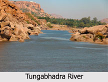
 Tungabhadra River is a major river in the south Indian peninsula which is a chief confluent of the Krishna River. The Hindus consider this river sacred and there is a mention of the river in Ramayana where it is referred to as Pampa. Tungabhadra River flows through the states of Karnataka and Andhra Pradesh. The river has a catchment area of 27,574 square miles. The tributaries of the Tungabhadra are Varada River and Hagari (Vedathy) River. In modern India, a huge dam and hydroelectric project is constructed across Tungabhadra River.
An important feature of the Tungabhadra River bank is the flood protection walls all along the river, constructed between 1525 and 1527 AD. It starts at Sringeri and ends at Kurnool, just few kilometres from its mouth. They are stone constructions which are still intact.
Course of Tungabhadra River
The merging of the two rivers, the Tunga River and the Bhadra River at Koodli in Shimoga district of Karnataka, gives birth to the Tungabhadra River. The Tunga and the Bhadra Rivers flow down the eastern slopes of the Western Ghats located in the state of Karnataka. After its birth, the Tungabhadra River takes a north-east direction where it flows through uneven ridges formed by boulders, which is the Deccan Plateau. The river meanders through the plains to a distance of 531 km and merges with the Krishna River at Gondimalla, near the famous Alampur in Mahbubnagar District of Telangana. The Krishna River continues in the east direction and evacuates in the Bay of Bengal. The locked land that lies in the north of Tungabhadra River between the Tungabhadra and the Krishna River is called the "Raichur Doab".
 Varada River flowing through Shimoga, Uttara Kannada and Haveri districts and Hagari River in Chitradurga, Bellary district, Koppal District and Raichur Districts in Karnataka and the Handri River in Kurnool district of Andhra Pradesh are the main tributaries of the Tungabhadra. Many rivulets and streams join these tributaries.
History of Tungabhadra River
The ancient name of the Tungabhadra River was Pampa. According to the legends, Pampa, the daughter of Brahma (the God of creation) did penance to pleas Lord Shiva. Impressed by her devotion Shiva married her and taken the name "Pampapati" meaning husband of Pampa.
Temples near Tungabhadra River
On the banks of the Tungabhadra River, there are a number of ancient and holy sites. At Harihara there is a temple dedicated to Harihareshwara. Surrounding the modern town of Hampi are the ruins of Vijayanagar, the site of the powerful Vijayanagar Empire`s capital city and now a World Heritage Site. Alampur, on the left northern bank of the river, known as Dakshina Kashi in Mahbubnagar District about 25 km from Kurnool is another important place, where the early Chalukyas built a cluster of temples. The Moola Brindavana of Guru Raghavendra is located on the banks of the Tungabhadra River at Mantralayam, Andhra Pradesh.
 Dams on Tungabhadra River
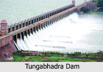
Tungabhadra Dam is across the Tungabhadra River. The dam is near the town of Hosapete in Karnataka. It is considered a multipurpose dam. Its storage capacity is 135 Tmcft. Owing to siltation; the capacity has been reduced by about 30 Tmcft. It has become a picnic or tourist spot over the years. Tungabhadra Dam is near to the heritage site Hampi.
Few miles upstream the Tungabhadra River from Mantralayam town, Interstate Rajolibanda barrage is located which supplies water for irrigation in Karnataka and Andhra Pradesh on the right bank of river.
Pollution in Tungabhadra River
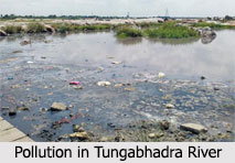
Industrial pollution has damaged the Tungabhadra River. Industry and mining on its banks in the Chikmagalur, Shimoga, Davangere, Haveri, Bellary,Koppal and Raichur districts of Karnataka and Kurnool in Andhra Pradesh and Mahbubnagar in Telangana generate enormous amounts of effluents. As such, it is one of the most polluted rivers in the country.
Downriver from the industries, the water has turned dark brown and has a pungent odour. Altogether, Tungabhadra River pollution has affected 1,000,000 people in the sub-basin as most villages used the river water, previously obtained through the ancient tank system, for drinking, bathing, irrigating crops, fishing and livestock water. The livelihood of village fishermen has been harmed by regular fish kills that have exhausted Tungabhadra River"s fisheries.


