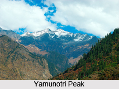
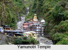
 Yamunotri Peak, one of the Indian mountain peaks is the source of the Yamuna River and the seat of the Goddess Yamuna. Yamunotri Peak is one of the four sites in India`s Char Dham pilgrimage. The sacred shrine of Yamunotri, source of the river Yamuna, is the westernmost shrine amidst the Garhwal Himalayas that is perched on top of a flank of Bandar Poonch Parvat. The chief attraction at Yamunotri is the temple devoted to shrine of Goddess Yamuna and the holy thermal springs at Jankichatti.
The actual source a frozen lake of ice and Champasar glacier is located on the Kalind mountain at the height of 4421 m above sea level, about 1 km further up. It is not frequented generally as it is not accessible and hence the shrine has been located on the foot of the hill. The approach to Yamunotri Peak is extremely difficult and pilgrims therefore offer pooja at the temple itself. The temple of Yamuna is situated on the left bank of Yamuna constructed by Maharaja Pratap Shah of Tehri Garhwal. The deity is made of black marble. The Yamuna like Ganga has been elevated to the position of divine mother for the Hindus and has been held responsible for fostering and developing the Indian civilization.
Close to the temple on the Yamunotri Peak are hot water springs gushing out from the mountain cavities. Suryakund is the most important Kund, near which there is a shila called Divya Shila, which is worshipped before puja is offered to the deity. Devotees prepare rice and potatoes to offer at the shrine by dipping them in these hot water springs, tied in muslin cloth. Rice so cooked is taken back home as prasadam.The pujaris of Yamunotri come from the village of Kharsali near Jankichatti. They are the administrators of the sacred place, perform religious rites, and are well versed in Shastras.
 The Yamunotri temple is located in the Indian state of Uttarakhand, which is a full day`s journey from Uttaranchal`s main towns, namely the Rishikesh, Haridwar or Dehradun. The actual temple on Yamunotri Peak is only accessible by a six-kilometer walk from the town of Hanuman Chatti and a four-kilometer walk from Janki Chatti; horses or palanquins are also available for rent. The hike from Hanuman Chatti to Yamunotri is very picturesque with beautiful views of a series of waterfalls.
Maharani Gularia of Jaipur built the original temple on Yamunotri Peak in the 19th century. The current temple is of modern origin as past creations have been destroyed by the weather and elements. Lodging at the temple itself is limited to a few small ashrams and guesthouses. The Uniyal family of pujaris (priests) performs the ritual duties such as the making and distribution of prasad (sanctified offerings) and the supervision of pujas (ritual venerations). Unique aspects of ritual practice at the temple of Yamunotri Peak include hot springs where raw rice is cooked and made into prasad. It is located at an altitude of 3,235 metres approximately. A little ahead is the actual source of the river Yamuna at an altitude of about 4,421 metres approximately. Hot springs are also boasts healing characteristics, offering relief to tired hikers.


