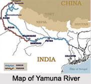
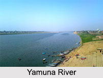
 Yamuna River is one of the most prominent rivers of northern India. The river is also known as `Jamuna`. A number of ancient evidences states that Yamuna River in the past was a tributary of Ghaggar River but with the due course of time, this river changed its course. The river has great value in Indian mythology.
Geology of Yamuna River
Geology of Yamuna River relates to the sediment analysis in the river and is known from the silt deposits in the riverbed. The sediments collected from Delhi and Agra urban centers were examined to know their concentration and distribution in the river by means of atomic adsorption spectrometry. About 9 heavy metals were found and their compositions were examined to be varied.
Geography of Yamuna River
Geography of Yamuna River relates to the features of Yamuna River. This river has a length of approximately 1,376 kilometers. It acts as the longest and the second largest tributary of the Ganges. Indian cities like Mathura, Noida, Hamirpur, Allahabad, Baghpat, Delhi, Etawah, Kalpi and Agra are located on the banks of Yamuna River.
Origin of Yamuna River
Origin of Yamuna River is known to be in the western Himalayan Mountain Range. More specifically, the river starts its journey from Yamunotri Glacier on the south western slopes of Banderpooch Peaks in Uttarakhand in the northern region of Haridwar, at an elevation of about 6387 meters above mean sea level.
Course of Yamuna River
 Course of Yamuna River relates to the journey of the river in India. The river originally traverses south and then southeast and runs parallel to and just west of the Ganges. More specifically, it flows in a southerly direction through the Himalayan Mountains on the plains of northern India and traverses through a series of valleys for about 200 kilometers along the border of two Indian states of Uttar Pradesh and Haryana. Yamuna traverses through Delhi also before merging with the Ganges at Allahabad.
Tributaries of Yamuna River
Tributaries of Yamuna River are several. Tons River, Betwa River, Chambal River, Ken River and Sindh River are the prime tributaries of Yamuna River. Tons River is the largest tributary of Yamuna River. Yamuna River unites with Ganga River after receiving water from all the major tributaries. It also merges with underground Saraswati River in Allahabad.
Wildlife and Surroundings of Yamuna River
Wildlife and Surroundings of River Yamuna relates to the species in the Yamuna River region and the river being a serene frontier of greenery, respectively. The surroundings of the river are abundant in wildlife. The boundary line of River Yamuna has a rare collection of Asian Elephants.
Religious Importance of Yamuna River
Religious Importance of Yamuna River is due to its relation with Gods and Goddesses of India. The goddess of River Yamuna, also known as Goddess Yami is the daughter of Lord Surya or Sun god and the sister of Lord Yama, the God of death. It is also believed that Lord Krishna had blessed the river, when Vasudeva was crossing it with baby Lord Krishna. When the baby fell in the river, the dust of Krishna`s lotus feet sanctified the river at once. Yamunotri, the source of River Yamuna forms the seat of Goddess Yamuna. This spot is considered as one of the four sites in the Char Dham Yatra in India. There is a temple dedicated to Goddess Yamuna, which remains closed from November to May. At Hanuman Chatti, the Hanuman Ganga converges with Yamuna River. According to various legends, this remote mountainous spot was the home of an ancient sage of India, Asit Muni. Triveni Sangam is the meeting point of the 3 legendary rivers of India namely, the Ganga River, the Yamuna River and the Saraswati River near Allahabad. This spot has become a well-known pilgrimage site in India. As per popular beliefs, people who undertake a dip in the sacred waters of Yamuna River are not besieged by death or fear. A hot water pool at Yamunotri is used for the preparation of "prasad", a food substance used during religious offerings.
Significance of Yamuna River
Significance of Yamuna River has been increased by several canals, especially in the Indo-Gangetic Plain. Vast tract of India has come under irrigation via these canals. Thus, Yamuna River has a vital role to play in agriculture in India Besides irrigation, Yamuna River has other utilities too. The cities which are located on its bank extort huge quantities of water for several uses such as industrial use.
Pollution and Protection of Yamuna River
Pollution and Protection of Yamuna River relate to the deterioration of the river due to the discharge of the pollutants and the consequent actions taken to restore it, respectively. The river is polluted particularly near New Delhi. A huge percentage of the city`s garbage is dumped into the river. However, a number of attempts have been made by the Government of India to clean this river. One such attempt is the Yamuna Action Plan.


