 Western Railway Zone of India is a part of the Indian railways. More specifically, it is one of the 17 railway zones of the country. It is headquartered at Churchgate Railway Station in Mumbai. An important aspect of Western Railway is the suburban railway system that extends from Churchgate to Virar. The Western Railway serves the western coast of India which, in turn, has a number of Indian ports. It is easy to access the Mundra Port, Bedi Port, Okha Port, Kandla Port, Bhavnagar Port, Navlakhi Port, Rozi Port and Pipavav Port via Western Railway. A Heritage Gallery has been opened by the Western Railway at Churchgate in the headquarter building. It will intimate the viewers with the history of Western Railway.
Historical Development of Western Railway Zone of India
Western Railway Zone of India was formed on 5th of November, 1951 by merging the Bombay, Baroda and Central India Railway (BB&CI) and the Saurashtra Railway, Rajputana Railway and Jaipur State Railway. The narrow gauge lines of Cutch State Railway and the railways of the various princely states of India were also amalgamated with the Western Railway. In 2002, the Jaipur and Ajmer divisions of the Western Railway were included in the newly formed North Western Railway. In April, 2003, the Kota division of the railway was included in the newly formed West Central Railway and a new division namely, the Ahmedabad division of the Western Railway came into existence. After the inauguration of Western Railway several projects were undertaken to extend the railway tracks under it. 
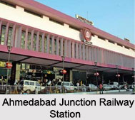
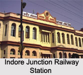
Presently, Western Railway Zone of India has six divisions namely, Mumbai Division, Vadodara Division, Ahmedabad Division, Ratlam Division and Rajkot Division. The major railway routes of Western Railway are Mumbai Central -Ratlam, Mumbai Central - Ahmedabad and Palanpur - Ahmedabad. Some of the Indian railway stations which come under the Western Railway are Mumbai Central Railway Station, Ahmedabad Junction Railway Station, Vadodara Junction Railway Station, Ratlam Junction Railway Station, Indore Junction Railway Station. There are both suburban and outstation railway lines belonging to the Western Railway. Western Railway is considered to be a front runner in executing the `Train Management System` (TMS) over its suburban section till Virar. This system provides real time information about train movements to commuters.
Trains of Western Railway Zone of India
Some of the trains of Western Railway Zone of India are Rajdhani Express, Gujarat Mail, Golden Temple Mail and Avantika Express. Besides Bhavnagar, Mumbai Central, Ratlam and Ahmedabad, there are trains to Delhi, Agra, Jaipur and Ajmer. Local trains also ply as a part of Western Railway. For the convenience of the travelers, Western Railway provides trains at an interval of 3 minutes during peak hours. It has the distinction of being the first railway in the world to introduce a special train exclusively for women running between Churchgate and Virar.


