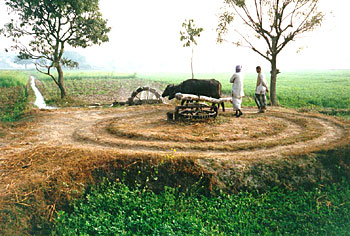
 Well Irrigation is a principal method of irrigation used in India. Underground water is tapped for drinking purposes and at the same time it is also tapped for irrigating the cultivated land. For implementation of this procedure, a hole is dug in the ground for providing perennial supply of soft water. This is done as saline water is not favourable for irrigation. For instance, in the drier parts of the country like Rajasthan, Haryana and Punjab, well water is quite saline. In order to reduce the salinity, wells are dug near ponds or in depressions where water generally collects during the rainy season. In those areas, crop cultivation is dependent totally on the rainfall.
In those areas of the country which are nearer to some rivers or receive considerable amount of rainfall, well water is basically found at shallow depths. Moreover, water in those areas is soft too. Well irrigation is mainly used in the alluvial plains of the country where well are relatively easy to dig owing to the soft nature of the soil. It is also found that in such areas, production of crops done with the usage of well water is quite rewarding. Generally, wells are dug in the middle of the land to be irrigated and which is at a bit higher level.
In India, areas where well irrigation is commonly used include plains of Uttar Pradesh, Punjab-Haryana plain, plains of Bihar and Gujarat, few places in Tamil Nadu, Narmada valley, Tapti valley and more. However, well irrigation method is not that common in the north eastern states of Assam and Tripura and also in rugged Himalayan belt. In this method, water from the well is lifted in several ways like by using Persian wheel, lever, etc. Wells are an important source of irrigation. However, it was more popular in the past. Presently, Hectarage under well irrigation has become very limited.
Well irrigation is definitely more popular in those regions where ground water is in plenty and where there are very few canals. The reasons for its popularity in those regions include its easy and simple working and it can also reduce the danger of water logging that is associated with canal irrigation.


