 Waterways in India significantly affect the economy of the country and are known to be well developed. India`s territorial waters continue up to 12 nautical miles. In the past, India was one of the seagoing countries. It was a primary ship-building country during the time of Napoleonic wars. Seamen used to sail far and wide, transporting Indian commerce and culture. It was only during the British dominion that India lost its reputation. India, since Independence has been trying to retrieve its doomed position.
Significance of Waterways in India
In the waters bodies of India, away from the shoreline are productive oil fields, like the Bombay High oil field which is about 115 km west of the coast. Coastal land deep-seal fisheries also depend on the waters bodies of India. With a long coastline and with India"s location near the major trading routes of the Indian Ocean, the natural outlet of the country is through the sea over which the maximum percentage of the entire foreign trade takes place. In this regard, it is important to note that near about 4/5th of the total volume of foreign trade of India is handled by Mumbai, Chennai, Kolkata and Vishakhapatnam ports. Mumbai is the leading port of the country and it is followed by Kolkata. At present, when all the coastal trade is handled by ships belonging to the country, the extended waterways of the country help in the shipping trade. The waterways are utilized by cargo, passenger or cruise vessels, etc to carry out trade.
National Waterways in India
There are 111 National Waterways in India. The network of the national waterways is spread about 20,275.5 km. These waterways serve the purpose of inland water transport. 106 National Waterways came into existence in the year 2016 and the ones which are functional are National Waterway 1, National Waterway 2 and National Waterway 3. Given below are some of the National Waterways in India.
National Waterway 1
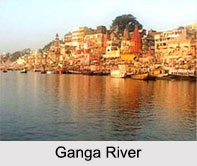
 National Waterway 1(NW - 1) is also called the Ganga- Bhagirathi River- Hoogly River System. This system continues from Haldia (Sagar) to Allahabad across the Ganges, Bhagirathi and Hooghly rivers. More specifically, the northern end of the National Waterway is Haldia (Sagar) and its southern end is Allahabad. Inland Waterways Authority of India (IWAI) is the owner of the waterway. This waterway is handled by Central Inland Water Transport Corporation (CIWTC). The waterway which has a length of about 1,620 km (1,010 mi) was opened on 27th of October, 1986. The waterway is well equipped with about 18 floating terminals.
National Waterway 2
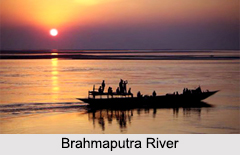
National Waterway 2 (NW - 2) covers a part of the Brahmaputra River, between the Bangladesh border and Sadiya. More specifically, the northern end of the waterway is Sadiya and its southern end is the Bangladesh border. Inland Waterways Authority of India (IWAI) is the owner of the waterway. This waterway is handled by Central Inland Water Transport Corporation (CIWTC). The waterway which has a length of about 891 km was opened on 1st of September, 1988. The waterway is well equipped with about 11 terminals.
National Waterway 3
National Waterway 3 (NW - 3) stretches from Kollam to Kottapuram. It is also known as National Waterway No 3. More specifically, the northern end of the waterway is Kottapuram and its southern end is Kollam. Inland Waterways Authority of India (IWAI) is the owner of the waterway. This waterway is handled by Central Inland Water Transport Corporation (CIWTC). The waterway which has a length of about 205 km was opened on February, 1993. The waterway is well equipped with about 9 terminals.
National Waterway 4
National Waterway 4 (NW-4) or the Indian National Waterway is situated in the Indian states of Telangana, Andhra Pradesh, Tamil Nadu and the union territory of Puducherry. Inland Waterways Authority of India (IWAI) is the owner of the waterway. This waterway is handled by Central Inland Water Transport Corporation (CIWTC). The waterway has a length of about 1,095 kilometers (680 mi). It was given the designation of a National Waterway, on 24th of November, 2008 following the Provisions of National Waterways Bill, 2006. The waterway is well equipped with about 15 terminals.
National Waterway 5
National Waterway 5 (NW-5) is located in the states of Odisha and in a part of West Bengal. Inland Waterways Authority of India (IWAI) is the owner of the waterway. This waterway is handled by Central Inland Water Transport Corporation (CIWTC). The waterway has a length of about 623 km. It was given the status of a National Waterway in November 2008.
Other National Waterways in India
Some of the other National Waterways in India are National Waterway 6, National Waterway 7, National Waterway 8, National Waterway 9 and National Waterway 10.


