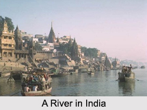
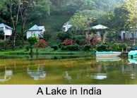
 Water Resources in India are part of the key, affluent and huge variety of natural resources in the country. Water is a fundamental human requirement and a valuable asset for the nation. It is an important source of creating food security in the country. Agricultural output is largely dependent on regulation and improvement of Water Resources in India. Total Water Resources in India are around 167 million hectare-meters, which have been derived after considering the total area and the average annual rainfall of around 50 cm. Out of this, only 66 million hectare-meters are available for irrigation in India.
Sources of Water Resources in India
About 80 percent of the area of India experiences rains of about 750 millimeters or more in a year. But rainfall in India shows very high sequential and spatial inconsistency. In India, the monsoon period generally lasts for around 3 to 4 months. More specifically, it is the monsoon season during which most of the rains occur. At this time, north east India and north India receive far more rains than west India and south India. Melting snow also acts as a source of water in India. Melting snow over the Himalayan Mountain Range after winter season adds water in the northern rivers in varying amounts. Thus, it can be comprehended that there is variation in the availability of water from different sources in different parts of India.
Indian rivers have a total average annual flow of about 1953 cubic kilometers per year. It has been estimated that the annual usable ground and surface water resources are around 396 cubic kilometers and 690 cubic kilometers, respectively. Along with rivers, reservoirs, tanks, canals, ponds and other small Indian water bodies form inland water resources in India. These are mostly present in the Indian states of Uttar Pradesh, Madhya Pradesh, Jammu and Kashmir, Tamil Nadu, Andhra Pradesh, Karnataka, Rajasthan, West Bengal, Gujarat, Maharashtra and Odisha, amongst others. The entire length of canals and rivers is about 31.2 thousand kilometers in Uttar Pradesh and Odisha has the highest area for salty water bodies. Lakes, wetlands, dams, barrages, lagoons, gulfs, estuaries and straits, etc are other sources of water in India.
 Shortage in the Availability of Water Resources in India
Around 9.7 million hectare-meters of water was available for agriculture in India before 1951. By 1973, almost 18.4 million hectare-meters of water was being supplied for agriculture and irrigation. India has extensive river systems, but safe and clean drinking water and water for irrigation and agriculture is inadequate across India. Although in the coastal plains of India and plains of northern India water resources are abundant, but in other regions supply of water is significantly insufficient.
In India, the utilizable ground water resources are considered to be approximately 40 million hectare-meters. In general, in particular areas, ground water can be drained from a depth of almost 15 meters. A vast portion of the nation faces shortage of surface water resources for most part of the year. Even areas like Konkan and Meghalaya which receive adequate rainfall, face deficiency of water during winter and summer months. Mawsynram in Cherrapunjee gets the world`s highest rainfall in the rainy season, yet it also experiences water shortages during other seasons. Water resources that are safe for ingestion cannot be provided in most of the Indian villages in the rural areas. Furthermore, villagers have to cover vast distances to gather water.
Improvement of Water Resources in India
With improvements in standard of living and growing population, demand for water resources increased along with reduction in the availability of water throughout India. Change in climatic conditions and rising pollution levels, deteriorated the quality of Water Resources in India. Thus, proper improvement and competent utilization of water resources became immensely important. In 1954, surface water exploration programme was initiated and drilling actions were undertaken in river basins and lower Himalayan areas. This programme gained further momentum during the 1990s, with the introduction of open-hole drilling equipments. Drilling was carried out in areas of Arunachal Pradesh and Jammu and Kashmir. Numerous wells were drilled to counter water deficiency in India, particularly in drought prone regions. Around 27,500 wells have been established by drilling, around the nation. These well are managed by the State Governments in India for providing water to the public.
Government of India has undertaken few programs and policies. More specifically, framing of policy guidelines, technical examination, sectoral planning, techno-economic appraisal and coordination of projects are part of the efforts made by the government. The programmes and policies support particular projects, facilitate exterior assistance, help in solving regional disputes related to water, help in the management of irrigation and aid in expansion and improvement of Water Resources in India. In order to accumulate river waters and improve ground water recharging, about 5,000 major or medium dams, barrages, etc have been constructed in India. For a stable development in Indian economy and improvement of environment, management of water resources should be integrated, as per the National Water Policy, 2002.


