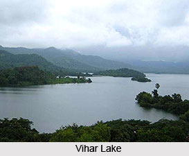
 Vihar Lake is a treat to all the weekenders of Mumbai and Maharashtra, after a busy life schedule. This lake serves not only as a tourist importance, but also it holds the beauty in the neighbouring surroundings, where the tourists, photographers and the migratory birds are easily attracted.
Location of Vihar Lake
Vihar Lake is located near Vihar village on the Mithi River within the grounds of the Borivali National Park, which is also known as Sanjay Gandhi National Park, in North Mumbai.
History of Vihar Lake
Vihar Lake was built in the year 1860, by the colonial empire of India. The construction of Vihar Lake was started in the year 1856 and took four years to complete this construction of the Vihar Lake, which is now maintaining the ecological balance and the tourist attraction as well. It was considered as the largest lake in Mumbai in the Salsette group of islands. It is bordered between the Tulsi Lake and the Powai Lake. It partly meets the drinking water needs of the South Mumbai region. It supplies only 3% of the Mumbai city"s water requirement, after filtration at Bhandup where the large water filtration plant is located.
Utility of Vihar Lake
With the few thousand wells feeding the population of Mumbai tending to go dry during summer, the acute shortage of water resulted in protests by the local residents in June 1845. A two man committee was appointed by the British Colonial Empire in India of the time, to examine the grievances of the agitators concurred with water shortage problem and stressed the urgent need to solve the water supply problem of Mumbai. The Committee appointed by the Government of Britain in Colonial India located suitable sites to construct dams and create reservoirs to store the monsoon flows of the Mithi river catchment, which resulted in presently existing Vihar Lake, Tulsi Lake and the Powai Lake. Vihar Lake reservoir was the first piped water supply scheme of Mumbai. In 1850, Captain Crawford submitted a report favouring the Vihar Scheme for the Mumbai city"s water supply needs. The work on the "Vihar Water Works" commenced in January 1856 and was completed in 1860, during the governorship of John Lord Elphinstone, the then Governor of Maharashtra. The Brihanmumbai Municipal Corporation (BMC) controls the affairs of Vihar Lake has also acquired agricultural land in the catchment area of the Vihar Lake as a sanitary precaution.
Visiting Information
Vihar Lake is easily connected with all the cities of Maharashtra and also in railways. By road, Vihar Lake is 31 km from Mumbai, Maharashtra. The access to Vihar lake by suburban electric train is to Kurla or Andheri and then by road.
Vihar Lake as a Tourist Spot
The access to Vihar Lake for the general public has been curtailed since March 13, 1993 following the bomb blasts on March 12, 1993 due to perceived threats to the Mumbai public, as the lake is located in the Sanjay Gandhi National Park. It can still be viewed in many Bollywood movies in a long shot taken from Mumbai Film City, as seen in the Infobox.


