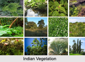
 Indian Vegetation is considered to be one of the richest in the entire world. India is indeed one of the few countries in the world that possesses varied vegetation. Indian vegetation is being protected and guarded with utmost care as it helps in generating huge amount of revenue and maintaining ecological balance in the nation. Different parts of India have different vegetation. The distinct vegetative regions in India have been classified on the basis of their location and climate. Due to a diverse geographical and climatic condition, an extensive range of natural vegetation grows in India. Cultivated crops and fruits, orchards form part of vegetation but not natural vegetation. Indian vegetation in different parts of India is described below:
Indian Vegetation in Himalayan Mountain Regions
Western Himalayan Mountains extends from Jammu and Kashmir to Kumaon in India. In this temperate zone, apples, cherries, strawberries, pears, peaches, walnuts, peanuts, almonds, apricots, etc are produced. The rare and priceless saffron is grown in the Kashmir Valley. The eastern Himalayan region extending from Sikkim to northernmost parts of West Bengal boasts of rich forests of oaks, birch, laurels, maples, alder, rhododendron, juniper and dwarf willows. Sikkim is also known for highly colourful orchids.
 Indian Vegetation in Indo-Gangetic Plain
Indo-Gangetic Plain covers eastern Rajasthan, Uttar Pradesh, Bihar and West Bengal and has vast cultivable lands. Here, vegetation comprises of major crops like rice, jute, wheat, sugarcane, bajra (pearl millets) jowar (sorghum), maize, mustard or rye and an infinite range of vegetables.
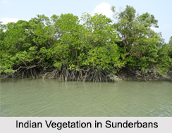
Indian Vegetation in Sunderbans
Sunderbans in West Bengal is the delta of the Ganges and the Brahmaputra River. Here, the area between high and low water has mangroves adapted to the unusual estuarine condition of high salinity and daily inundation by high tides. They help in preventing soil erosion.
Indian Vegetation in North-East Indian States
North-east India, comprising of states such as Assam, Nagaland, Manipur, Mizoram, Tripura, Meghalaya and lower regions of Arunachal Pradesh is suitable for the cultivation of numerous fruits like cherries, plums, squashes, oranges and pineapples.
 Indian Vegetation in Deccan Plateau
Deccan Plateau comprises of the entire tableland of the Indian peninsula. Black soil is spread over the entire Deccan Plateau. This soil makes the region suitable for cotton cultivation. The elevation of Deccan Plateau has an important role to play in the cultivation of orange in the region. More specifically, orange cultivation is carried out in the Nagpur region of Maharashtra. The highly popular sandalwood is an evergreen tree, which commonly grows in the dry deciduous forests of the Deccan Plateau. It also grows in Karnataka, Tamil Nadu, Kerala and Andhra Pradesh.
Indian Vegetation in Malabar Region
Malabar region of India covers excessively humid belt parallel to the western coast of Indian peninsula. In this region several major commercial crops like coconut, betel nut (supari), black pepper, coffee, rubber and cashew nut are grown.
Indian Vegetation in Western Ghats
Western Ghats encompasses only 5 percent of the Indian vegetation, but it acts as a home to more than 4,000 plant species. Nilgiris, a part of the Western Ghats is known to be a key producer of tea and coffee.
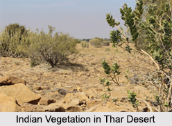
Indian Vegetation in Thar Desert
Thar Desert of western India comprises of short and corpulent trees. These trees are stunted due to scorching sun and lack of moisture. Guar, Babul, Reunjha, Keekar and numerous species of cacti like Khejra, Kanju and Khajur are common in the region.


