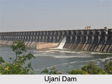
 Also known as the Bhima Dam or the Bhima Irrigation Project, the Ujani Dam is located on the Bhima River near the Ujjani village in Solapur district of the state of Maharashtra. The Ujani Dam is an earth-fill cum masonry gravity dam and out of the 22 dams formed by the Bhima River, it is the terminal dam on the river and is the largest in the Bhima Valley that intercepts a catchment area of 14,858 sq. km.
Features of Ujani Dam
Created as a multi- purpose reservoir, the construction of the Ujani Dam project including the canal system on both the banks was started in 1969 at an initial estimated cost of Rs.480 million. The entire project was completed in June 1980 and the cost incurred was of the order of Rs.3296 million. With a total length of 2,534 m, the Ujani Dam is founded on massive basaltic rock formations and comprises of a central portion which is the spillway dam of 602m in length. The total capacity of the reservoir created by the dam is 3,140,000,000 metre cube with a total surface area of 337 sq. km.
 Benefits of Ujani Dam
Elaborately discussed below are the various benefits of the Ujani Dam:
Irrigation: The storage created by the Ujjani Dam has resulted in the irrigation of 500 sq. km particularly in the Solapur district, which has resulted in an increase in the yield of jowar and groundnuts. The irrigation component of the Ujjani Dam project was co-financed by International Fund for Agricultural Development and the World Bank with specific objective to enhance the social and economic conditions of the Scheduled castes and Scheduled tribe people in the command.
Hydropower: The pumped storage type powerhouse has been built at the toe of the Ujani Dam with an installed capacity of 12 MW. In the year 2015, it was a drought year when the inflows into the reservoir were very meagre due to failure of rains in the catchment area. But with minor external modifications to the exiting reversible hydro turbine unit, all the dead storage water was put to use during the drought years by using the hydro power plant for pumping water into the nearby left canal.
Other than these, there is a high density of phytoplanktons in the Ujani reservoir which is highly conducive to an increase of fish species. The average fish yield is reported to be 2450 kg per sq. km of the water spread area of the reservoir. The production of fish resources from the reservoir has been estimated at 712 tonnes per year, and 19 percent of the catch consists of species of major carps.
Pollution of Ujani Dam
The water quality of the Ujani Dam is very bad as it contains hazardous pollutants from Pune and many other small cities located on the banks of Bhima River or its tributaries. Recent surveys conducted has revealed high levels of nitrates, chemical oxygen demand (COD) and biochemical oxygen demand (BOD), which suggests that the water from the Ujani Dam is not potable and should not be used for agriculture.


