 Udhagamandalam is abbreviated as Udhagai, is a city, a municipality and the capital of the Nilgiri district in South Indian state of Tamil Nadu. It is also called as Ootacamund. But everywhere it is known as Ooty. In the local language of Tamil, the literary meaning of Ootaca is Otta-Cal, which means `single stone` and the name Udhagamandalam is derived from the Toda word `Othakal-mund`, which means `House of mountains`.
History
Ooty or Udhagamandalam rightly described as "Queen of Hill Stations". In ancient times the Nilgiri hills were part of Chera Empire, later on it fell into the hand of Ganga and then came under Hoysala dynasty in 12th century. Before coming in the hands of British in 18th century, it was ruled by Tipu Sultan under the Kingdom of Mysore.
John Sullivan, the British governor of the neighbouring Coimbatore province, liked the climate of Udhagamandalam and occupied it by taking lands from the native tribes (Toda, Irumba and Badaga). British citizens bought many square kilometers in a day for the price of few meals to these tribes.
The Hills were developed rapidly under British Raj, because British citizens had owned almost the entire place. Ooty was served as the summer capital of Madras presidency.
Geography
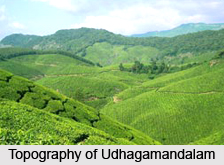
Ooty has covered the area of 36 sq. km. With a number of small hills and rolling hills covered with dense vegetation.
It is situated at an altitude of 2,240 meters above sea level. Maximum temperature is 24.3°C and minimum temperature is 4.8°C. The climate of Ooty is salubrious. Annual rainfall of this district is 991mm.
 Economics
Wetlands of Nilgiri areas are highly productive and cradles of biological diversity
lands. Except the main corps like Paddy and Sorghum, it also produces, tea, areca, coffee, pepper, tapioca and cardamom. Tea estates, hotels and shops in the various visiting places are the main livelihood sources of Ooty people.
Government and Politics
A collector, who is belonging to an officer of Indian Administrative Service, is the head of the Udhamandalam. He is assisted by one Deputy Collector .
The Superintendent of police, an officer belonging to the Indian Police Service, is responsible for maintaining the law and order and related issues in the district.
Transport
By Air: The Coimbatore airport, situated around 105 kilometers from Ooty is the nearest airport.
By Rail: Ooty is in the narrow gauge railway, connected to Metupalayam, which is directly connected to Coimbatore to Chennai.
By Road: A good network of roads and national highways connect Ooty with all major towns and cities. There are regular bus service to Coimbatore, Tirchy, Madurai, Kanya kumari, Palghat, Calicut, Tirupati and it is also well connected with major cities of Kerla and Karnataka.
Demographics
As per 2001 Census, Udhagamandalam had a population of 93,921. Males constitute 50% and female constitute 50% of the total population. 9% of the population is under six year of age. It has an average literacy rate of 80% higher than the national average of 59.5%. Male literacy rate is 84% and the female literacy is 75%.
 Culture
The main languages used in Udhamandalam are Badaga, Tamil, Kannada, Hindi, Malayalam and English.
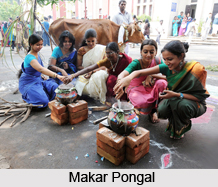
Makar Pongal in January, Thaipoosam in Elk Hill Murugan Temple, Mariamman annual festival, in February, Ooty Mariamman festval in April are the main festivals celebrated in Ooty.
Tea and Tourism festival is celebrated in the month of January, the popular flower show and fruit show is held in May at the botanical gardens every year. Tourism Department of Tamil Nadu also arranges boat races and Boat pageantry during summer vacation.
Visiting places in Ooty
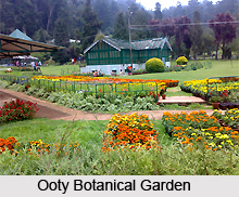
Ooty Botanical Garden- The 22 acre botanical garden was laid out in 1847 and presently maintained by Tamil Nadu Government.
Stone House- This was the first house of Ooty made by stones. John Sullivan builds this stone house. It is situated inside the premises of Government of Art Collage.
The Railway Station- The railway station is the part of the World heritage Site. It offers a unique glimpse of the British Raj built railways.
The Ooty Lake and Boat House- This is an artificial lake built by John Sullivan. It used to be much larger than its present size.
The Fernhill Palace- This former palace situated around one kilometer from the Ooty bus stand can be visited for an entry fee of Rs.50. now it has converted into a hotel.
Among the famous Church Kandal Cross Shrine,St. Stephen Church are very much popular.
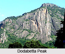
Dodabetta Peak- The highest point in the Nilgiri Hills, at an altitude of 2,623m.There is also a reserved forest area around the peak. It is 10 kilometer away from Ooty.
Ketty Valley- There is a viewpoint called "Valley view" on the way to Ooty Coonoor road.
Pykara lakes and Falls- Pykara Falls is situated at a distance about 19 kilometer from Ooty.A boat house and picnic spot is also developed near the lake.
Kamraj Sagar Lake- This lake is situated near the Pykara falls.
Mudumalai National Park- It is situated at a lower altitude and easily accessible to visitors.
Mukurthi National Park- This is a large protected area and not accessible for the visitors. It also contains a lake and peak of the same name.
Parsons valley Reservoir- This is the primary water source for the town and mainly in a reserved forest, where visitors are not allowed.
Emerald Lake- This Lake is situated near the Emerald town.
Avalanchi lake- Avalanchi Lake is situated near the emerald lake. This is situated in a reserved forest, which is a restricted area.
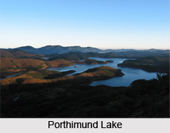
Porthimund Lake- This Lake is situated in a reserved forest.
Upper Bhavani Lake- This lake is situated inside the Mukurthi National Park.

Flora and Fauna
There are several wild life Sanctuaries and preserved national forests can be easily found here. Most of the reserved forests are full of Tea and Eucalyptus trees. Mudumalai Wild Life Sanctuary, Kotagiri, Coonoor, Mukurthi Peak and National Park are the important places to find the flora and fauna of Ooty.
Mundumalai Wild life sanctuary is basically a bird sanctuary, spreading in the area of 321 sq.kms. it is the first sanctuary in the southern India, with its varied terrain comprising of hills, ravines, swamps and the numerous varieties of animal and plant species.
Coonoor is famous for its lush green valleys. The little town situated about 19 kilometers from Ooty. It is located on the Hulikal Ravine at an altitude of 1,800 m. this is a perfect place for the adventurous activities like, Trekking and Hiking.
Education
There are several famous institutions in the Ooty. Among them the important schoola are:-
•GHSS Ooty.
•Hebron School,Ooty.
•Breeks All India Hr. Sec. School.
•Laidlaw Memorial School.
•The Lawrence School Lovedale Ooty.
•Kendriya Vidyalaya Ooty.
•Woodside School.
•Kingsbury Montessori School.
•Blue Mountain School.
Important collages of Ooty are.
•CSI College of Engineering College.
•Government Art college.
•Emerald Heights collage.
•Monarch International College of Hotel Management.
•JSS College of Pharmacy.
•Swiss Merit Inn College of Hotel Management.
•Merit International college of Technolgy.
Few other institutions are:-
Hindustan Photo Film- It is an Industrial Unit, situated about 5 kilometer from Ooty railway station. It is spread over about 300 acres. This unit produces number of film products here.
Cosmic Ray Laboratory- It is situated in the Mutholai village of the Nilgiris. This is a research center for the experiments of cosmic rays.
Radio Telescope- The Ooty radio telescope is an important instrument set up at the radio astronomy center. This is an important place for research in radio astronomy and astrophysics.
