 Types of Soil erosion in India are many and they are mainly caused due to the action of natural agencies as water and wind and also of artificial or man made agencies like deforestation, mining and so on. There are various types of soil erosion like Normal or geologic erosion, Accelerated soil erosion, wind erosion, water erosion, sheet erosion, gully erosion, landslides or slip erosion and stream-bank erosion.
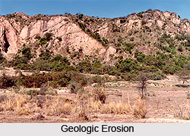
Geologic Erosion
Normal or geologic erosion is a normal feature of any landscape. Geologic erosion takes place gradually but so slowly that ages are required for it to make any noticeable alteration in the major features of the earth`s surface. There is always equilibrium between the removal and formation of soil, so that unless some outside agents disturbs the equilibrium, the mature soil preserves more or less, a constant depth and character indefinitely. Accelerated soil erosion is the removal of the surface soil from areas denuded of their natural protective cover as a result of human and animal intrusion takes place at a much faster rate than that at which it is built up by the soil-forming process. This accelerated detachment that rapidly ravages the land and it is with this type of soil erosion that is considered of a serious concerned. Nature requires, on an average, about 1000 years building 2.5 cms of top soil but wrong farming methods may take only a few years to erode it from lands of average slope.
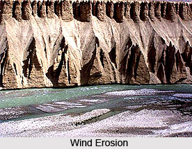
 Wind Erosion
Wind erosion takes place normally in arid and semi-arid areas that is devoid of vegetation, where the wind velocity is high. The soil particles on the land surface are lifted and blown off as dust storms. When the velocity of the dust-bearing winds is retarded, rough soil particles are deposited in the form of dunes. Thus, fertile lands are rendered unhealthy for cultivation. In other places, fertile soil is blown away by winds and the subsoil is exposed, as a result the productive capacity of the soil is considerably reduced. Water erosion causes severe soil erosion and this category of soil erosion can be distinguished in three forms, namely sheet erosion, rill erosion, and gully erosion. Sheet erosion usually removes a thin covering of soil from large areas, often from whole fields, more or less, uniformly during every rain, which produces a run-off. This type of erosion is very menacing, since it keeps the cultivator almost ignorant of its ill effects. It is usually neglected, although the soil deteriorates slowly and unnoticeably. Its existence, however, can be detected by the muddy colour of the run-off from the fields.
Gully Erosion
Gully erosion occurs when rill erosion is neglected. The tiny grooves develop into wider and deeper channels, which may assume a huge size. This state is called `gully` erosion. Gullies are the most spectacular evidence of the destruction of soil. The gullies usually deepen and widen with every heavy rainfall. They cut up large fields into small fragments and, in course of time, make them out of shape for cultivation. Landslides or slip erosion is another type of soil erosion. A landslide is defined as an outward and downward movement of the slope-forming material, composed of natural rocks, soil, artificial fills, etc. The elementary causes of landslides are topography of the region and geological structure, the kinds of rocks and their physical distinctiveness. The immediate cause of a slide may be an earthquake, or a heavy rainfall, which excessively saturates the ground or a part of a road. However, these are accidents rather than fundamental causes.

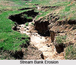
Stream Bank Erosion
Stream-bank erosion occurs when torrents or hill streams come down by wide-spreading beds on emergence from the hills with ill-defined banks, flashy flows and swift currents. Usually, they are dry watercourses, except during the rainy season when with every downpour in their catchments areas, they get exceedingly swollen with flood and subside almost to its normal tiny size immediately after the storm is over.
These sudden and aggressive flows are strongly responsible for moving immense quantities of debris, comprising boulders, shingles, sand and silt, depending upon the geology of the topography. This debris gets deposited in the torrent bed in the form of dotted islands owing to the sudden widening of the torrent channel after it emerges from the hills, or owing to the flattening of the slope in the lower reaches, or because of obstructions caused by wild vegetation and uprooted trees. These deposits raise the bed level of the torrent. These deposits, in turn, reduce the transporting capacity of the torrent, thus resulting in overflows and the winding of the course and in the soil erosion of the banks. Soil erosion has become a grave issue in India and the government is taking measures to sustain the land`s productivity.


