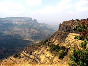
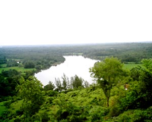
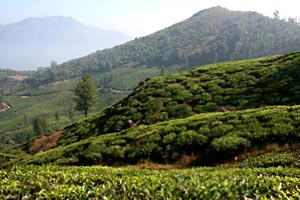
 The Tropical semi-arid steppe climate covers the entire Indian coastal belt and adjoining areas. The climate in this region is hot with extreme rainfall during the monsoon season, from June to September. The Southern parts of the belt experiences hot, seasonally dry tropical savana climate while most of the northern half experiences hot, semi-arid, tropical steppe type of climate. The climate of this region however varies with the seasons. South of Tropic of Cancer and east of the Western Ghats and the Cardamom Hills are the places experiencing such type of climate; it includes the states of Karnataka, interior Tamil Nadu, western Andhra Pradesh and central Maharashtra.
The winter season in tropical semi-arid steppe climate starts from January upto February and is followed by summer season from March to May. The period from October to December forms the post-monsoon season. The period is generally pleasant over the entire region except during a few spells of rain associated with north-east monsoon which affects the south-eastern parts of the State during October to December. The months of April and May are extremely hot, very dry and generally uncomfortable. Weather is usually very oppressive during June owing to high humidity and temperature. The next three months, namely July, August and September are somewhat comfortable due to reduced day temperature although the humidity continue to be very high.
The tropical semi-arid steppe climate is a transitional climate between the tropical wet and tropical dry climates. The controlling factors of the climate are similar to that of the tropical dry climate, though temperatures are cooler and annual precipitation is higher. Thus, tropical semi-arid steppe climate is considered to be steppe climate semi-arid rather than completely arid. The climate of the tropical steppe is a direct result of its interior continental location and proximity to the subtropical high. The tropical steppe is not as dry as the tropical desert climate, owing to its proximity to a source of moisture.
 Unlike the mid-latitude climates where the seasons are marked by the change from warm temperatures to cold, in the tropical dry climates seasons are notable on the basis of it, being warm and excessively warm. The generally cloudless conditions that exist in the tropical steppe allow much insulation in to warm the surface of these areas. The very high temperatures are also due to the proximity of the climate to the air mass source regions. Mean annual temperature in the tropical semi-arid steppe climate is approximately 20oC (68oF). These regions are usually located pole ward of the tropical wet climates; the annual temperature range increases as the variation in sun angle increases at these locations. Annual temperature ranges vary from 10oC (5.6oF) to above 20oC (11oF). Daily temperature ranges are nearly similar to the annual range of temperature.
The tropical semi-arid steppe climate denotes a semi-arid environment. To climatologists, a semi-arid environment is defined as one where the annual potential evapo-transpiration is more than half but less than the total annual precipitation. Potential evapo-transpiration is a compute of the demand for water on the explanation of plant transpiration and surface evaporation. In the tropical semi-arid steppe climate, much evaporation and plant transpiration would take place if water were available. Inadequate amounts of precipitation during the comparatively long summer droughts stress plants that require water during periods of high temperature. However, during the wet tenures of the year, ample rainfall occurs to meet the needs of the natural vegetation.
 The tropical semi-arid steppe climate is a transitional climate between truly wet and truly dry climates. The seasonality of rainfall is similar to that of the closest humid climate. The steppe climate found between the tropical desert and wet/dry tropical climate of the regions has a high sun wet - low sun dry seasonality to its precipitation. During the low sun period the subtropical high migrates into this region and suppresses convection. The subsiding air lowers the relative humidity making it difficult to bring air to its saturation point. During the high sun season the tropical steppe is dominated by the subtropical high. During the low sun season cyclones associated with the sub polar low and polar front usually dominate.
Some regions with tropical semi-arid steppe climate are found on the lee side of mountains. As air ascends the windward slopes, water vapour condenses and precipitation occurs. The places located on the leeward side are thus in the "rain shadow" and are usually dry.


