 is one of the major rivers of southern India, which is considered sacrosanct by the Hindus. The river rises at Talakaveri in the Brahmagiri hills of the Western Ghats in Karnataka. It flows in the south and east through Karnataka and Tamil Nadu and then across the southeastern lowlands and finally surrenders in the Bay of Bengal through two principal mouths. The tributaries of River Kaveri are responsible for the water resource in southwest India.
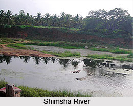
Shimsha River is the major tributary of Kaveri River, flowing in southern India. One of the tributaries of the Cauvery River is the Shimsha River that flows in southern part of India. The river originates in the southern part of the Devarayanadurga hill at an average elevation of 914 metres, which is located in the Tumkur district of Karnataka. The total length of the river is two hundred and twenty one kilometers and has a catchment area of about 8,469 square kilometers. Maddur is a major city that lies on the bank of the Shimsha River.
The Hemavati River is a very important tributary of the Kaveri River. The river begins its journey in the Western Ghats at a height of about 1,219 metres, near Ballala Rayana Durga in the Chikmagalur District of Karnataka, in southern India. the river then flows through Chikkamagalooru, Hassan District and Mysore district before merging with the Kaveri near Krishnarajasagara. It is approximately 245 km long and has a drainage zone of about 5,410 sq km. A large reservoir has been built on this river at Gorur in the Hassan district.
Arkavathy River is a river, which originates at Nandi Hills of the district of Kolar. The Arkavathy River is also considered to be an offshoot of River Cauvery. After flowing through the rural districts of Bangalore and Kolar, River Arkavathy merges at the Kanakapura confluence. The catchment area of River Arkavathy is about 4351 square kilometers.
 The Honnuhole River is a tributary of the Kaveri River in Karnataka, India. The Lakshmana Tirtha is a river of India that has its origin in Kodagu district and flows eastward. Kabini River is a tributary of Kaveri and flows in the India state of Kerela. In the vast country of India, several rivers flow through the entire region, thereby making the country so rich in flora and fauna and also tracts of lush green trees and vegetation. In the southern part of India, Kabini River, also popular as Kabini only, has drawn the attention of so many tourists of India.
A major tributary of the Cauvery River is the Bhavani River, which is the second largest river in Tamil Nadu. The river is two hundred and seventeen kilometers long and flows through the states of Kerala and Tamil Nadu. The drainage basin of this perennial river is spread over an area of 6,200 square kilometers, out of which, eighty seven percent is in Tamil Nadu, nine percent in Kerala and four percent in Karnataka. The river mainly flows through Coimbatore and Erode districts of Tamil Nadu. The major towns situated on the banks of the river are Mukkali, Athikadavu, Koodappatti, Mettupalayam, Bhavanisagar, Sathyamangalam,Aapakudal, Gobichettipalayam, Aavudaiaaparai, Bhavani.
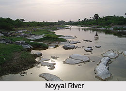
The Lokapavani River is one of the tributaries of River Kaveri and it flows near the Karighatta hills. The Noyyal River starts from the Vellingiri hills in the Western Ghats in Tamil Nadu. The river comes down to southeastern India and empties into the Kaveri River. The length of the river basin is 180 km and it is 25 km wide, covering a total area of 3,500 km² (1351 mi²). The fertile land in the basin is around 1,800 km² (695 mi²) while the population density is around 120 people per km² (311/mi²) in the countryside and 1000 people per km² (2590/mi²) in the cities.
The Amaravati River is a tributary of Kaveri River in southern India. The Amaravati River begins in the Anjanda valley of Kerala State in India. The location of this river is in between the Aanamalai Hills and the Palni Hills near the bottom of Manjampatti Valley. The Pambar and Chinnar rivers feed it.


