 The word `Trichur` is derived from the Malayalam name of the town `Thri-Siva-Perur`, meaning the town of Lord Siva. And thus suitable to its name, the town is alive with religious and spiritual activities and festivals throughout the year. Temples form the main attractions within the state. The miniature lanes of this town are constantly buzzing with activities in large numbers. The chief population comprises of the Nestorian Christians whose existence dates back to the 3rd century AD.
The local performing arts such as Kathakali and the Kalaripayattu are highly practiced within the schools and institutions. A number of cultural institutions in the region provide courses in traditional music, instruments, and dance forms. The Thrissur Pooram festival is celebrated during the months of April-May. This is the main festival out of the hundreds of temple festivals in the region. It is also the most colorful festival within the state of Kerala and is witnessed by thousands of people from all over the state, nation, and the world.
History:
Thrissur District has played a significant part in the political history of south India since ages. The early political history of the District is interlinked with that of the Cheras of the Sangam age. They ruled over vast portions of Kerala with their capital at Vanchi. The whole of the present Thrissur District was included in the early Chera Empire. The District can claim to have played a significant part in fostering the trade relations between Kerala and the outside world in the ancient and medieval period.
Kodungalloor which had the unique distinction of being the `Primum Emporium India`, also belongs to the signal honour of having first given shelter to all the three communities which have contributed to the prosperity of Malabar. These three communities are the Christians, the Jews and the Muslims respectively. The history of Thrissur District from the 9th to the 12th centuries is the history of Kulasekharas of Mahodayapuram. The history since 12th century is the history of the rise and growth of Perumpadappu Swarupam.
In 1790 Raja Rama Varma whose lifetime was 1790-1805. He was popularly known as Saktan Tampuran ascended the throne of Cochin. With the accession of this ruler the English or modern period in the history of Cochin and of the District began.
 Saktan Tampuran was mainly responsible for the destruction of the power of the feudal chieftains and also increase of royal power. Another potent force in the public life of Thrissur and its suburbs was the Namboodithiri community. A large part of the Thrissur Taluk was under the domination of the Yogiatiripppads for long, who was the ecclesiastical heads of the Vadakkunnathan and Perumanam Devaswoms.
The wave of nationalism and political consciousness has its consequences in the District which swept through the country since the early decades of this century. Thrissur District can claim the honour of having been in the forefront of the country-wide movement for temple entry and abolition of untouchability. The famous Guruvayur Satyagraha is a memorable episode in the history of the national movement.
District profile:
The district was formed on 1st July`1949. The district headquarters is placed at Thrissur and the geographical area covers 3032 sq. km. There are three primary constituencies and fourteen Assembly constituencies present in the district. The number of taluks is five and villages are two fifty-four in numbers. There are one corporation, six municipalities, one district panchayat, seventeen block panchayat, and ninety-two gram panchayat.
Geographical Features:
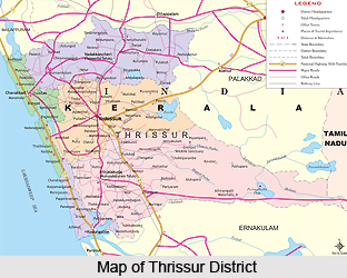
The four boundaries of Thrissur district can be mentioned as in the West there is Arabian Sea, in East there is Palakkad District and also part of Tamil Nadu, in South part of Malappuram and Palakkad Districts are there and in the North Ernakulum district is situated.
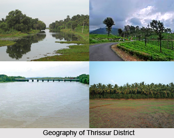
The types of soil present in part of Mukundapuram, Thrissur and Chavakkad is Sandy loam, the Eastern part of Thrissur and Western part of Thalapilly experiences the Laterite soil, in back water area of Chavakkad and Mukundapuram the sand type is Clayey while Alluvial soil is present in parts of Chavakkad.
Geographical details: The total population of the district is 29,75,440, which can be expressed in percentage as 9.34. Density of population is 981 per sq. km. The sex ratio is 1092 female and 1000 male. The literacy Rate of the district is 92.56%; the male literacy is 95.47% while female literacy is 89.94%. The numbers of urban families are 14471 while the numbers of rural families are 225077.
General Facilities: The district is full of facilities for its habitant as well as for tourists. There are Primary health centers, Community health centers, Ayurveda hospitals, Homeopathic hospitals, Laprosy hospital, Radio station, tourist spots, Enginnering College, Law College, medical college, Fine arts College, and Agricultural University.


