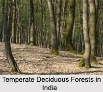
 The temperate deciduous forest has four distinct seasons, spring, summer, autumn, and winter. In the autumn the leaves change colour. During the winter months the trees lose their leaves. It usually consists of a cold winter, warm spring, hot summer, and a cool autumn, with a temperature range of -30Aø C to 30Aø C. temperate deciduous forest gets about 51-152 centimetres of rain every year. There is an approximately 6 month growing season. The 20 to 60 inches of precipitation is distributed evenly throughout the year. The non-growing season is due to temperature-induced drought during the cold winters. Many of the same genera, previously part of an Arcto-Tertiary Geoflora, are common to all three of the disjunctive northern hemisphere expressions of this biome. Included among these genera are Quercus (oak), Acer (maple), Fagus (beech), Castanea (chestnut), Carya (hickory), Ulmus (elm), Tilia (basswood or linden), Juglans (walnut), and Liquidamber (sweet gum).
Various zones in Temperate Deciduous forest
There are five different zones in this type of forest. The first zone is Tree Stratum zone, containing trees like as oak, beech, maple, chestnut hickory, elm, basswood, linden, walnut, and sweet gum trees. The height of trees in this zone ranges between 60 and 100 feet.
 The second zone is the small tree and sapling zone, having young and short trees. The third zone or the shrub zone consists of rhododendrons, azaleas, mountain laurel, and huckleberries. The Herb zone is the fourth zone containing short, herbal plants. The final zone is the Ground zone containing lichen, club mosses, and true mosses. Oaks are one of the dominant tree species in the deciduous forest. Other important trees include hickories and walnuts (right); formerly the chestnut was a dominant tree until the chestnut blight was introduced and decimated this key species. Maples, beech, sycamores and a host of other trees also play a role in the forest and we will meet some of them later.
Wildflowers are also common in the forest, although they need some unusual strategies to survive on the heavily shaded forest floor. Many bloom early in the spring, before the big trees have leafed out, and may shed their leaves and remain dormant underground through the remainder of the summer.
The animals have adapted to the land by trying the plants in the forest to see if they are good to eat for a good supply of food. Also the trees provide shelter for them. Animal use the trees for food and a water sources. Most of the animals are camouflaged to look like the ground.
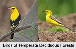
Resident bird species also tend to be omnivores. Many, like the several species of woodpeckers and the chickadees, are cavity-nesters. Migratory species tend to be insectivorous and include many so-called Neotropical migrants, including warblers, wrens, thrushes, tanagers, and hummingbirds.
Broadleaf trees tend to be nutrient demanding and their leaves bind the major nutrient bases. Thus the litter under this forest is not as acidic as under needle leaf trees and aluminium and iron are not mobilized from the A-horizon.
 A lot of deciduous forests have lost land to farms and towns. Although people are trying to protect the forests some poachers are trying to kill the animals in the forests. The animals are losing their homes because of people building their homes. It is no coincidence that a good deal of the human population is found in areas that once supported temperate forests. The soils are rich and easily converted to agriculture. The climate is warmer than the boreal forest. That is one of the reasons there aren`t a lot of original deciduous forests left in the world. Other threats to the forest come from logging; most of the trees here are hardwoods, which mean they have a denser wood than most of the coniferous trees. Acid Rain from coal burning is another threat, as is global warming, which in particular may change rainfall patterns.
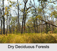
The eco region extends across the Indian states of Bihar, Orissa, and Madhya Pradesh. It represents a north-south-directed island of dry deciduous forests in the rain shadow of Eastern Ghats Mountain Range and is completely surrounded by the Eastern Highlands
Moist Deciduous Forests. Most of these forests are open scrub influenced by human activities.
The Kathiawar-Gir forests in the main part of the ecoregion comprise the Aravalli Range and the eastern half of Rajasthan state, extending into eastern Gujarat and the Malwa region of Madhya Pradesh.
Like many of the Deccan Plateau dry forest eco-regions, this region does not harbour large numbers of endemic species, nor is it exceptionally rich in biodiversity.


