 Sundargarh District is an administrative district of Odisha. The district headquarters is located at Sundargarh. Sundargarh District is also known as Sundergarh District. This district was constituted on 1st of January, 1948 out of two ex-states of Gangpur and Bonai, which merged with Odisha on that day.
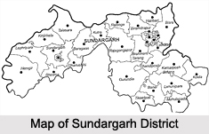
Location of Sundargarh District
Sundargarh District lies in the north western portion of the sate. This district is located at 21 degree 36 minutes north to 22 degree 32 minutes north latitude and between 83 degree 32 minutes east to 85 degree 22 minutes east longitudes. Total geographical area of Sundargarh District is 9712 sq kms. Sundargarh District is bounded by Ranchi District of Jharkhand on the north, Raigarh district of Chhattisgarh on the west and north-west, Jharsuguda District, Sambalpur District andAngul District of Odisha on the south and south-east and Singhbhum District of Jharkhand and Keonjhar District of Odisha on the east.
History of Sundargarh District
Two princely states of Gangapur and Bonai constitute the present district of Sundargarh, consequent upon their merger in 1948. In the past, the district comprised the territory of South Kosala. However, divergent views are available regarding the origin of the ruling family. But these ex-states were once under the sovereignty of Sambalpur which formed part of the dominion of the Maratha Rajas of Nagpur. They were ceded to the British Government in 1803 by the Maratha Chief Raghuji Bhonsla of Nagpur under the treaty of Deogaon. But they were restored to him by special engagement in 1806. They were finally ceded in 1826. In 1905, they were transferred from the control of the commissioner of Chota Nagpur Plateau to that of Odisha and a separate political agent was appointed.
Geography of Sundargarh District
 Geographically, Sundargarh District is not a compact unit. It consists of widely dissimilar tracts of expansive and fairly open country dotted with tree-clad isolated peaks, vast inaccessible forests, extensive river valleys and mountainous terrains. The region of Sundargarh District is an undulating tableland of different elevations broken up by rugged hill ranges and cut up by torrential hill streams and the rivers Ib (major tributary ofMahanadi River) and Brahmani. The general slope of the district is from north to south. Because of this undulating, hilly and sloping nature of landscape, the area is subject to rapid runoff leading not only to soil erosion but also to scarcity of water for both agriculture and drinking purpose. Alluvial soil and Lateritic soils are mainly found in Sundargarh District. There is an open well-cultivated plain country along the valley of the Ib River particularly in the south. The rest of the Sadar sub-division consists of undulating table-land about 700 feet in average height, dotted here and there with hills and peaks rising to about 2000 feet. The portion occupied by Bonai sub-division to the south-east has rugged forest and hills intersected by gorges and passes and having a narrow valley of the Brahmani River and its tributaries. The east and west of the Brahmani valley is filled with high range of mountains.
Demography of Sundargarh District
Total population of Sundargarh District is 18, 29,412 as per 2001 Census. Male population of the district is 9, 34,902 that accounts for around 75.69 percent of the total population and female population of the district is 8, 94,510 that accounts for nearly 54.25 percent of the total population.
Administration of Sundargarh District
Administration of Sundargarh District comprises three sub-divisions, nine tehsils and 17 Community Development Blocks. It has 9 towns and 1744 village (1688 inhabited villages and 56 uninhabited villages). Further, Sundargarh District has 262 Gram Panchayats. Sundargarh District is a tribal dominated district. There are several small scale industries in this district.
Culture of Sundergarh District
Sundargarh District is said to have abundant mining potential. Main languages spoken in the district are Oriya language, Bengali language, Hindi language, Telugu language and Urdu language.
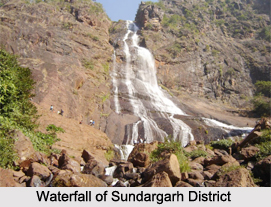
Tourism in Sundargarh District
The forest of Sundargarh District is of northern tropical dry deciduous type, mainly containing Sal, Assan and Kurum. The forest area is mostly studded with rich mineral deposits, like iron, manganese, limestone, lead; also forest products like bamboo, timber and Kendu leaf which are export-oriented. The forests occupy an area of 3534.92 sq kms which includes 2664.64 sq kms under reserved forest and 612.07 sq kms under protected forest. Sundargarh District is one of the beautiful districts of the state with about 43 percent of its total area under forest cover and numerous colourful tribes dotting its landscape.
Related Articles
Odisha
Districts of Odisha
Temples of Odisha
Odisha Cuisine, Indian Food
Nature Tourism in Odisha
Puri


