Home > Indian History > Geography of India > Subarnarekha River
Subarnarekha River
One of India’s main interstate and rain fed river, the Subarnarekha River holds historical and economical significance in the country. the river originates from Jharkhand and finally joins Bay of Bengal.

Share this Article:

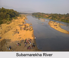
Subarnarekha River, Indian RiverAlso known as Swarnarekha, the Subarnarekha River is the smallest of India"s main interstate river basins. The Subarnarekha River has reddish blue water and flows through the states of Jharkhand, West Bengal and Odisha.

Multipurpose projects executed on Subarnarekha River relate to the construction of Chandil Dam, Icha Dam and Galudih Barrage. These structures on the river are useful to the farmers of the three eastern Indian states.

Etymology of Subarnarekha River
The name Subarnarekha is a combination of 2 languages, Sanskrit and Bengali. The words "Subarna" stands for gold and "Rekha" stands for a line or streak. Thus, Subarnarekha means a "streak of gold" in English. According to traditional stories, it is believed that gold was once mined near the origin of the Subarnarekha River and was even found on the river bed. Thus, the river received the name of Subarnarekha.

Course of Subarnarekha River
Subarnarekha River originates near a village namely, Piska or Nagri close to Ranchi. With a drainage area of about 1.93 million hectares, the Subarnarekha River traverses for a long distance through the districts of Ranchi, Seraikela Kharsawan and East Singhbhum. It then covers short distances through Paschim Medinipur district in West Bengal and Balasore district in Odisha. Subarnarekha River finally joins the Bay of Bengal, near Talsari.

Tributaries of Subarnarekha River
The major tributaries of Subarnarekha River are Kharkai River, Roro River, Kanchi River, Harmu Nadi, Damra River, Karru River, Chinguru River, Karakari River, Gurma River, Garra River, Singaduba River, Kodia River, Dulunga River and Khaijori River.

Places of Interest near Subarnarekha River
There are various places of interest near Subarnarekha River, like the Chandil Dam, which is one of the most visited places in the area. The museum located close to the Chandil dam has scripts written on rocks, which are 2,000 years old. Another of the popular places of interest near the river is the Hundru Falls, which is located at a distance of about 45 km from Ranchi and falls from a height of about 98 m. There is also a temple dedicated to Lord Shiva called the Bhavnatha Mahadev Temple, situated on the banks of Subarnarekha River that attracts devotees from all over. Other than these, located close to the Subarnarekha River is a hill station in the Chota Nagpur Plateau region of Jharkhand that is a popular tourist location.

Pollution in Subarnarekha River and its Effect
Subarnarekha River crosses areas where extensive mining of copper and uranium ores takes place. Thus, the river gets polluted due to the unplanned mining activities. Subarnarekha River is the lifeline of the tribal communities inhabiting in the Chhota Nagpur region of India. The lives of the tribal people are adversely affected by water pollution.


Share this Article:

Related Articles

More Articles in Geography of India


Geography of Uttar Pradesh
The fourth largest State in India UP is located in the Northern part of India whose area is 2,36,286 sq Kms.
Geography of Maharashtra
Covering an area of 308,000 sq. km, Maharashtra, the third largest state in India.
Geography of Kerala
Geography of Kerala includes plains, hills, valleys and coasts. With the Arabian Sea in the west, the Western Ghats in the east and networked by several rivers, Kerala enjoys diverse geographical features.
Geography of West Bengal
The geography of West Bengal is unique with high peaks of the Himalayan range in the north, the Bay of Bengal in the south and the remaining region is covered with both plains and plateaus.
Geography of Jharkhand
Geography of Jharkhand is comprised of the rich mineral resources and the highly agricultural prospect in this state.
Geography of Sikkim
Geography of Sikkim is characterised by a vast array of magnificent hillock that extends from one corner of the state to the other.
Geography of Meghalaya
The suitable climate, highland plateaus, rivers and the flora and fauna together forms the geography of Meghalaya.
Geography of Mizoram
Mizoram is surrounded by hills, valleys, rivers, waterfalls and lakes. The hills range from 1000 meters to 2000 meters. Rivers, lakes and waterfalls also play major role in forming the land of Mizoram.
Geography of Jammu & Kashmir
Jammu and Kashmir is encompassed by valleys. Some of the dominant valleys of the state are Kashmir Valley, Tawi Valley, Chenab Valley, Poonch Valley, Sind Valley and Lidder Valley etc. Jhelum River is the only major Himalayan River which flows through the Kashmir valley. Indus, Tawi, Ravi and Chenab Rivers are the major ones flowing through the region.
Geography of Daman and Diu
Daman and Diu is situated on the west coast of India and are the smallest union territories of India.
Geography of Goa
Geography of Goa occupies a prime location along the Konkan coastal belt on the western coast of India. The state is bordered by Maharashtra in the north and Karnataka in the south. The Western Ghats in the east contribute to the flora and fauna of Goa.
Geography of Arunachal Pradesh
Geography of Arunachal Pradesh reveals that it is a hilly tract nestled in the foot of Himalayas.
Geography of Kutch
Geography of Kutch District is covering an area of 45,612 km. Kutch District is the largest district in the state of Gujarat.
Geography of Ladakh
Geography of Ladakh mainly comprises the huge Karakoram Range with long stretch of cold desert which mark the region separately from the rest of the states of Indian subcontinent. Surrounded with the mountain ranges from all corners this small region separates Indian subcontinent from rest of the Asian continent.
Geography of Rajasthan
Geography of Rajasthan defines the dry topography with arid climate of the western mountain region.
Geography of Tamil Nadu
The Indian state of Tamil Nadu is located in the Northern hemisphere in the hot zone.