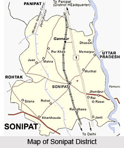
 Sonipat District, an administrative district of Haryana, has its district headquarters situated in Sonipat. The name of the district is derived after its headquarters town, Sonipat. Other smaller towns of this district are Gohana, Ganaur, Mundlana, Kharkhoda and Rai. The total area of Sonipat District is 2,260 sq km. As per 2001 census, total population of the district is 1278830, of which male population is 695314 and female population is 583516. The district population constitutes around 6.07 percent of the total population of the state. Sonipat District is bordered by Delhi and Uttar Pradesh as well as by Rohtak District, Jind District and Panipat District. Yamuna River runs along the eastern boundary of Sonipat District.
History of Sonipat District
Sonipat was earlier known as Sonprastha, which later on became Suvarnaprastha, meaning the `Golden City`. Over a period of time, the pronunciation of Suvarnaprastha got distorted into Swarnpat, and then to its current form, Sonipat. The earliest reference of this city comes in the epic Mahabharata, and at that time, it was one of the five villages demanded by the Pandavas in lieu of the kingdom of Hastinapur. It is believed that it was founded as Suvarnaprastha by the Pandavas, although it has been noted much earlier by Panini in his celebrated Ashtadhyayi. The town was therefore already in existence around 600 BC. Sonipat District has been carved out of Rohtak District and made a full fledged district on 22nd of December, 1972.

Geography of Sonipat District
Sonipat District is a part of Punjab Plains with a general slope from south to west. Some areas of the district are not levelled. Soil of the district is loamy and sandy in texture. The soil here is rich and quite suitable for all types of agricultural crops as well as forest cover. Sonipat District may be divided roughly in three physical regions namely the Khadar, upland plain and sandy region. Climate of the district is dry with extremely hot summer and cold winter. The weather becomes comparatively mild during monsoon period July to September. The district experiences high humidity during the monsoon period. The annual rainfall varies considerably from year to year.
Administration of Sonipat District
Sonipat District comprises three sub-divisions namely Ganaur, Sonipat and Gohana and seven development blocks - Ganaur, Sonipat, Rai, Kharkhoda, Gohana, Kathura and Mundlana. Sonipat is the largest tehsil followed by Gohana. Sonipat District has 347 villages, out of which inhabited villages are 332 and uninhabited villages are 15. The irrigated area (both with the help of canal irrigation as well as through tube wells) is 2, 86,504 acres and the un-irrigated rain fed area is 43,979 acres. Sonipat is the largest Tehsil in the district followed by Gohana Tehsil.
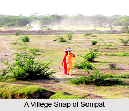
Sonipat District is primarily rural in nature and the primary activity of the people is agriculture. Thus, the economy of this district is agrarian in nature. However, water logging that is a serious problem in the district affects the productivity of land.


