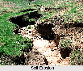
Soil erosion in Eastern Zone is largely a result of the kind of farming practices practised here. The north-eastern hills of Sikkim, Arunachal Pradesh, Meghalaya, Manipur, Mizoram, Assam, Nagaland, Tripura and Northern West Bengal fall in this zone. Many tribal communities practise shifting cultivation (Jhuming) in this zone. It takes several forms and comprises of a wasteful cycle. Natural vegetation is cut and burnt. Soils in cleared patches are rich. Agricultural crops are raised for short periods (1-3 years). The eastern zone is also a high rainfall area. Soil working on slopes is greatly damaging. The productivity of soils under Jhum cultivation falls steeply. Very soon, agriculture becomes uneconomical in such Jhumed patches and then this patch is left fallow. A new patch of rich natural vegetation is cleared and thus the cycle goes on. Earlier, the fallow period used to be long- around 10 to 40 years. This time period allowed natural regeneration. Soil used to get replenished. Productivity used to get restored. Now, all that has changed. The fallow period has been drastically reduced. This leads to more intensive working and it accelerates soil loss.
 Shifting cultivation is an integral part of the life of these tribal communities. Operation from clearing of forests to harvesting are closely inter woven with their life. Shifting cultivation is intimately blended with their beliefs, rituals, customs and festivals. Shifting cultivation used to be an ideal of utmost land productivity. It used to be an optimal mix of agricultural, hortipastoral and silvipastoral system. It was so when Jhuming cycle was longer (close to 40 years). Increased population shortened the Jhuming cycle. In places it has now been reduced to 2 years. Productivity has fallen. Many Jhumed areas are as good as wastelands. Low productivity pushes Jhuming areas progressively larger. With reduction in period of its cycle, shifting cultivation has become a great biodegradation factor in the Eastern zone.
Landslides are also common in this part of the country. Small landslides often waste the top soils. Steep slopes and high rainfall produce torrents causing stream bank erosion. Waste riverine lands exist. They are flooded during monsoons. The reservoirs silt up, river beds fill up and swollen rivers overtop banks with progressively increasing ferocity. Floods have become quite common in these affected parts. Gully erosion manifests itself in areas never known before.
Low reservation in forests is characteristic of the East zone. Private ownership of forest is also seen here. Non-sustainable commercial felling of forests in recent past has done great damage. Many landslips of the past have graduated to huge landslides now. Weak geological formations demand careful handling of hill slopes in this region. Subsidence is also common. Better moisture leads to regeneration of some or other vegetation. Consequently, even extensively overgrazed, bare mountain slopes keep, willy-nilly, soils more or less protected from splash and sheet erosion. But these slopes can not tolerate excavation. Cutting for road construction damages slopes profoundly. Cut and fill slopes are highly unstable as this concentrates land slips along hill roads.
Thus it can be seen that soil erosion in the Eastern zone, apart from being the result of a number of physiographical factors, is mostly due to human practices of farming.


