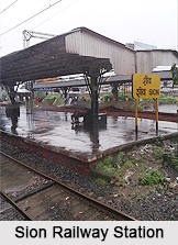
 Sion is located on the Mumbai suburban railway in the Central Railway line. The name Sion originated from the word `Shiva`. During the 17th century, the village Sion formed the boundary between Mumbai and Salsette Island. Every day the station caters to thousands of passengers because the place has many educational institutes like, Sadhana Vidyalaya English & Marathi Primary & Secondary School - Sion (W), Mumbai; D.S. High School; Little Angels` High School; Our Lady of Good Counsel High School; A.M.Kewalramani Premier High School; Amulakh Amichand Bhimji Vividhalakshi Vidyalaya; Gandhi Memorial English Primary School. - Dharavi, Mumbai; Guru Nanak National High School Sion (West), Mumbai; Little Angels English Secondary School - Sion (West), Mumbai; Our Lady of Good Counsel Primary School- Sion, Mumbai; People`s Welfare Society`s High School - Sion (East), Mumbai; Shree Vallabhashram School - Sion (West), Mumbai; St. Anthony`s English Primary School Dharavi, Mumbai; P Bhuta sion sarvajanik school, sion (west); Matunga Premier High School; Karmaveer Bhaurao Patil Vidyalaya, Sion (East); Sion Koliwada Municipal School; Gauridutt Mittal School (Sion Village); S.I.E.S. College of Arts, Science and Commerce - Sion West; S.I.E.S. College of Commerce and Economics, Sion East; K J Somaiya Institute of Engineering and Information Technology; K J Somaiya Medical College; Lokmanya Tilak Municipal Medical College; G.N. Khalsa College of Arts, Science & Commerce; Manohar Joshi College Mayank Maheshwari.
Sion Fort; CineMax multiplex (formerly Rupam Theatre); Aurora Theatre; Gurukripa restaurant-renowned for pani puris,samosas and vadapavs; Sheev Koliwada Village; Mothya Devi Mandir (Shiv Koliwada), where lakhs of devotees from all over Maharashtra visit during Navratri; Lada Devi, Nama Devi and Sitla devi Gram daivat Mandir near Sion Fort under Gram panchayat of Sheev Koliwada Village; Navratri fest of Shiv Koliwada; Holi festval Full moon day of Dancing by Koli women; Hanuman tekdi mandir; Motimsar gramdaivata Mandir are the main attractions of the place for which every year millions of passengers use the Sion station.


