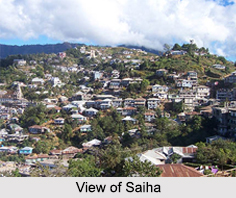
 Saiha District is one of the districts of Mizoram. It is situated on the southernmost fringe of the North-eastern region of India and is bordering Myanmar on the eastern and southern side. It has its administrative headquarters at Saiha town. Saiha District is surrounded by Lunglei district on the north and northwest and by Lawngtlai district on the west. It covers an area of 1399.9 sq kms. Saiha District has a total population of 60,000 as per the 2001 census. Saiha, the district headquarters, is the third most developed and also the third most populous town in Mizoram. It is also the capital of the third largest tribe, the Maras in Mizoram.
Administration of Saiha District
Administratively, Saiha District is divided into two blocks namely Saiha and Tuipang. Saiha block has 37 Village Councils and Tuipang block has 41 Village Councils. The district area comes under Mara Autonomous District Council under the Sixth Schedule of the Constitution of India. The Councils function like mini- Legislative Assemblies with powers to pass their own laws and rules, subject to approval by the Administrator (Governor of Mizoram).
Tourism in Saiha District
Saiha District is known for its scenic beauty. There are several tourist spots as well. Some of the popular attractions of Saiha District are as follows:
Pala Tipo (Lake): Pala Tipo or Pala Lake is the biggest Lake in the state of Mizoram and it is situated in the western part of Maraland near Phura. The Lake is surrounded by thick forests.
Saikao: This place is popular for the Missionaries House, which was built around 60 years ago. It is still intact and is one of the most visited tourist places.
Mt. Mawma: It is one of the most visited sites along with the cemetery of the Maraland missionaries.
Visiting Information on Saiha
Saiha is easily accessible from Aizawl as well as other district headquarters like Lawngtlai, Lunglei etc. Lumding Junction Railway Station and Sethlun Heliped at Lunglei are the nearest to Saiha. National Highway 54 passes through Saiha.
This article is a stub. You can enrich by adding more information to it. Send your Write Up to content@indianetzone.com.


