 Roadways in India form a complex network in the country. The network of roads in India is known extend over 5,472,144 kilometers (3,400,233 miles). As of 31st of March, 2015, the network attained the distinction of being the second largest road network in the world.
Roadways in India have preceded Indian railways. They are spread almost in the same areas where the railways are spread. Roadways in India have an edge over railways, in analysis of the effortlessness with which they have been constructed and preserved. Construction as well as maintenance of the railways is less economical, comparatively. Roadways are constructed and maintained easily and economically in the plains or hills of low relief. Thus in such areas, roadways attain supremacy over the railways. As the government of India is federal, roadways in India are controlled by various government authorities.
Raw Materials Used to Develop Roadways in India
Raw materials used to develop roadways in India have been diverse. They comprise of concrete, cement, bitumen, stone, burnt bricks, etc. It is important to note that bitumen-based macadamized roads have principally been constructed in India. Development of roadways in India depends on the availability of the type of raw materials in a particular region. For example, in the plains of northern India, road building materials are not cheaply available because of long distances. Stone is available near the foothills of the Himalaya Mountain Range. From this region, boulders are collected and broken into pieces that form the source of road constructing material in the alluvial plain.
Types of Roads in India
Roads are of two kinds, based on their strength and make up. They are surfaced and unsurfaced. Surfaced roads are leveled with the surroundings. They may be constructed out of cement, concrete or bitumen or tar and coal. Since Independence of India, surfaced roads have increased by more than 8 times. Surfaced roads are finest and are all weather roads. Unsurfaced roads are those roads which do not have a durable finished upper layer. They are of little use during the Indian monsoon season. However, the importance of unsurfaced roads cannot be downplayed. These roads open up the countryside to the contemporary methods of living and value system, based chiefly on money. Also, majority of the traffic is carried through unsurfaced roads.
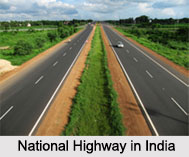
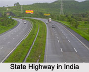
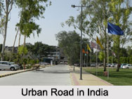
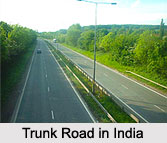
Types of roads in India are varied. Indian roads have been classified as national highways, state highways, other PWD (public works department) roads, rural roads, urban roads and project roads. Moreover in India, border roads are considered important from the defense point of view. The trunk roads often follow the ancient tracks that are not direct. All the Indian national highways are surfaced roads and the Indian state highways are also surfaced to the tune of around 97 percent. National highways comprise the leading arterial routes in India. Further, they alone account for the major proportion of the total road transport demand of India.
Development of Roadways in India
Development of roadways in India dates back to approximately 2800 BC and coincides with the existence of Indus Valley Civilization. Later, rulers in India brought about the development of roadways. But it is important to note that at the time of Indian Independence in 1947, the country had a poor road network infrastructure. An organization called the National Highways Authority of India was created in India in 1988. Its task was to develop, maintain and manage India`s road network through national highways. The organization has privatized road network development in India, since 1995.
With regards to development of roadways in India, it is important to note that improved road communication has been considerably extended to almost all the regions of the country. Indian villages that were initially cut off during the rainy season have now been well connected with the main roads. Moreover, there has been progressive multiplication of buses, cars and trucks on the roadways in India, in the past few decades. Over the years, with the tremendous increase in traffic, many roads have been broadened and made straight.
Density of Roadways in India
Density of roadways in India varies from place to place.  The network of roadways is densest in the Indian states of central West Bengal (more specifically, around Asansol), Tamil Nadu, Kerala, Karnataka, plain of Punjab-Haryana and some patches in the Ganga Plain. Regions of the lowest density of roads are very thinly peopled such as the arid western Rajasthan, hilly and forested areas of Bastar District, rugged Himalayas and Satpura Mountain Range.
Significance of Roadways in India
Roadways in India help the transportation segment of the country to contribute about 4.7 percent towards the gross domestic product. These roadways carry over 65 percent of India"s freight traffic and about 85 percent of its passenger traffic. They help in traversing forests and pass across deserts. Roads connected by Indian bridges help to cover strong rivers, even in times of sudden water gushing. They can be built on higher gradients of slopes and can span Indian mountains, such as the Himalayas.


