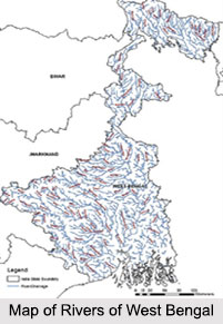
 Rivers of West Bengal greatly influence the geography of the region and lifestyle of the residents. Meandering through different regions of the state these rivers form important means of transport as well as trade. Apart from this, they also support the life of the people by supplying water for various purposes like agriculture, industries and many more. The rivers also affect the soil texture by enriching them with various minerals, which in turn support various industries and commercial units.
Bhagirathi River
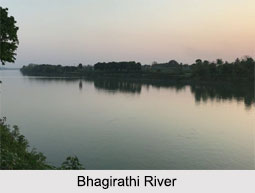
One of the main rivers in West Bengal, the Bhagirathi River flows past some of the important cities like Murshidabad, Berhampore, Nabadwip, Chinsura, Chandannagar, Serampore, Howrah, Kolkata, Diamond Harbour and Haldia. It releases its water into Bay of Bengal near Sagar Island in the South 24 Parganas Other rivers like the Mayurakshi, Ajay, Damodar, Kangsabati, Rupnarayan and their tributaries rise in the Western plateau and high lands flow eastwards through the different districts of West Bengal and joins the Bhagirathi on the right bank.
 Ajay River
Ajay River originates from a small hill from the south west of Munger town in Bihar. It enters West Bengal at Simjuri situated near Chittaranjan. The river forms the border between the state of Jharkhand and Bardhaman district. The river passes through hills along the laterite soil. History has recorded about 14 floods in this river during 20th century.
Balason River
Balason River flows in the district of Darjeeling in West Bengal. The hills of Senchal are the origin of the river. From the point of origin its flows in the south direction and enters the plains of North Bengal where it meets Mahananda River.
Churni River
Churni River flows in Nadia district of West Bengal. This 56 km long river flows through various regions and near Chakdaha town meets Bhagirathi River. It exhibits a lower course of flow owing to large amount of sediments and numerous small, often submerged river islands. During 1930s the river served as a major trade route of undivided Bengal.
Damodar River
Damodar River, which flows through West Bengal, was earlier recognized as the "Sorrow of Bengal" owing to the floods that played havocs on the plains of West Bengal. The river valley has rich deposits of minerals for which it greatly supports large-scale mining and industrial activities. It originates in the Chandwa region of Jharkhand state.
Gosaba River
Gosaba River flows in and around the Sunderbans, situated in South 24 Pargana district of West Bengal. The river originated by the confluence of Matla and Raimangal rivers. It is a tidal estuarine river and has a large estuary to Bay of Bengal
Hooghly River
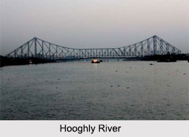
Hooghly River flows for about 260 km and is one of the distributaries of Ganga River of West Bengal. In Murshidabad district it branches off from Ganga, precisely at the Farakka Barrage. The town of Hugli- Chinsura which was previously known as Hooghly is situated on bank of the river. In ancient times the East India Company sailed through this river and reached Bengal for establishing their trade. Presently the river plays a vital role by providing a major water supply for irrigation, industry and human consumption.
 Yamuna River
The Yamuna River is a significant river of North 24 Parganas district of West Bengal and is the tributary of Ichamati River. Meandering courses and sharp bends form the distinguishing features of this river. Though being a major river, Yamuna is highly polluted. The river is also known to have created several oxbow lakes.
Kalindi River
Kalindi River flows around Sunderbans of North 24 Parganas district. It is a tidal estuarine river. It forms the border of Satkhira district of Bangladesh. It is a tributary of the Ichamati River.
Matla River
Matla River also flows around the Sundarbans. It is branched into two arms near Purandar. At South Bishnupur village, the river meets Adi Ganga River and the confluence is considered very sacred where numerous pilgrims take a holy dip on the auspicious day of Makar Sankranti. Matla River becomes highly turbulent during monsoons making it difficult for the boats to ferry people.
Rupnarayan River
Rupnarayan River originates in the Chota Nagpur plateau foothills, near Purulia district of West Bengal. The river then passes through the town of Bankura where it is called Dwarakeswar River. The river finally joins the Hooghly River. The Rupnarayan River is famous for Hilsa fish.
Subarnarekha River
Subarnarekha River originates at Ranchi in Jharkhand and enters the state of West Bengal through Paschim Medinipur district. On the course of the river, Hundru Falls forms which falls from a height of 98 m. The river flows through a length of 470 km.
Teesta River
Teesta River forms the border between the states of Sikkim and West Bengal. The river has carved out several gorges and ravines. It flows through a length of 309 km. The river passes through different regions of West Bengal and finally joins with the Brahmaputra River.
Other Rivers of West Bengal
Other rivers of West Bengal include Atrai River, Bakreshwar River, Barakar River, Brahmani River, Dharla River, Dwarka River, Haldi River, Hinglo River, Jaldhaka River, Kangsabati River, Kopai River, Mahananda River, Muri Ganga River, Piyali River, Rasulpur River, Saraswati River, Torsa River and many more.


