 Rivers of Chhattisgarh adorn the Indian state and shapes the affluence of the region. The rivers of Chhattisgarh are of much significance to the state from a stand point of economic, social, political and religious views. Chhattisgarh, situated amidst lush green hills and plateaus, is interspersed with several rivers that flow through the state. Due to the presence of natural drainage systems, Chhattisgarh is blessed abundantly with prolific and fertile plains. There is a huge demand for water required for irrigation and cultivation. Most of the major towns and cities of the state have emerged on the banks of the rivers. Raipur, the capital of Chhattisgarh, is situated on the banks of Kole River. Moreover, Maniyari River flows through Taalagaon, Jagdalpur is placed on the river banks of Indravati River and Bilaspur is located near river Arpa.
Numerous religious and pilgrimage destinations have also emerged near these rivers. Danteshwari temple in Dantewada is located on the confluence of two rivers, namely Dankini and Shankini Rivers. Moreover, Rajim is situated on the confluence of the rivers Sondhul, Mahanadi and Pairi. The Rivers of Chhattisgarh have become a major tourist attraction in the state due to the various beautiful waterfalls and stunning rapids in the rivers.
The most significant rivers of Chhattisgarh are Narmada River, Mahanadi, Godavari River, Indravati and few more. The state is manly drained by these rivers and their tributaries, distributaries and streams. The Mahanadi River basin, which is segregated by the Chota Nagpur Plateau and the Satpura Range, is considered as the central portion of the state. Northern region of the state includes the Indo-Gangetic Plain where as the southern part comprises of the Godavari river and tributaries.
The major rivers that flow through Chhattisgarh are mentioned below-
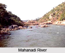
Mahanadi River
The Mahanadi River originates from the highlands in Raipur district of Chhattisgarh. Other than Chhattisgarh, Mahanadi flows through Orissa, Maharashtra and Jharkhand and reaches the Bay of Bengal. The major tributaries of the river are Mand, Hansdeo, Shivnath, and Tel rivers. The fertile lands on the banks of Mahanadi River are rather fertile which helps in cultivation of sugarcane, rice, oilseeds and other crops. This contributes to the economic condition of Chhattisgarh.
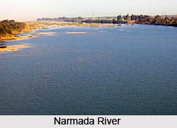
 Narmada River
Narmada originates from the Satpura range in Amarkantak of Chhattisgarh. The Narmada River moves from east towards west and reaches the Arabian Sea. In Chhattisgarh, it is also known as Reva, and the sacred river is believed to be associated with Lord Shiva. The people of the region believe that viewing Narmada River is considered as an auspicious sight and thus it is a well renowned religious and pilgrimage site.
Indravati River
Indravati River is perhaps the most significant and largest rivers of Chhattisgarh. Indravati River mostly covers the Bastar district and flows west, and consists of numerous tributaries. In Bhadrakaali of Dantewada district, the river unites with the Godavari River. The river is strong and powerful in its flow in Chhattisgarh and consists of Rocky River bed. Indravati River comprises of many waterfalls and rapids, which act as an attraction for many tourists. The Tirathgarh falls is the most popular waterfall of the region, with a height of around 100 feet.
Godavari River
The Godavari River is of much significance in this Indian state. Other than Chhattisgarh, the river flows through Maharashtra, Karnataka, Orissa, Andhra Pradesh and Madhya Pradesh, and ultimately unites with the Bay of Bengal. The catchment area of the river in Chhatisgarh is almost 39087 sq km. moreover, the river facilitates the generation of Hydel power through the several hydro electric projects. The people of the state consider the river as holy and sacred, thus many religious places have sprung up on its banks. Further more, Godavari provides abundant water for irrigational purposes in Chhattisgarh.
Shivnath River
Shivnath River flows through Durg district in Chhattisgarh and other parts of the state and provides drainage solutions. It is joined by Kharun River, and later unites with the Mahanadi river, as one of it tributaries. The river is also important from religious point of view. Various rituals are conducted on its banks like Kaalash Jatra and Snan Mahotsav. The river also has negative impact on Chhattisgarh as floods that occur due to the river, damage a lot of lives and properties.
Other than these, there are several other rivers that flow through Chhattisgarh and drain the entire region. These include Arpa River, Hansdeo River, Mand River, Sabari River, Sondur River, Tandula River, Sileru River, Dankini-Shankini River, Ib River, Pairi River, Kharun River, Kotri River, Jonk River, Sankh River, Rihand River, Sondur River and some others.


