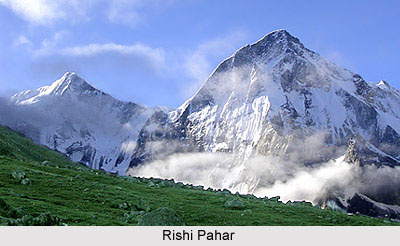
 The Rishi Pahar is located in the easternmost part of the Himalayas in the Pithoragarh district in the state of Uttarakhand. Uttarakhand is often referred to as the Land of the Gods for housing myriad holy Hindu temples and pilgrimage centres.
The Rishi Pahar lies on the northeast corner of the ring of peaks surrounding Nanda Devi Sanctuary. Standing at an elevation of 7,816 metres, the Nanda Devi is the second highest mountain in India. The Rishi Pahar lies on the eastern rim of the Nanda Devi Biosphere Reserve, which is a national park located at the peak of the Nanda Devi. Rishi Pahar stretches to the south towards Himalayan Mountains of Trishuli and Hardeol. The Milam Glacier lies on the eastern side of this mountain and marks the triple divide between the Milam, Dunagiri, and Uttari Rishi Ganga valleys.
The Rishi Pahar Mountain was first scaled in the year 1975 via the easiest route of the western ridge. The mountain is quite popular among the enthusiastic travellers and photographers.
Visiting Information on Rishi Pahar
The Jolly Grant Airport is the nearest while the Haridwar railway station is the closest from this area.
This article is a stub. You can enrich by adding more information to it. Send your Write Up to content@indianetzone.com


