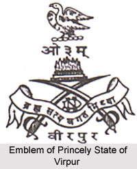
 The Princely State of Virpur was amongst the major native states during the rule of the British Empire in India. During the early 19th century, the region was assigned as one of the princely states of India under the indirect rule of the British administration. The territory covered a total area of 66.6 sq miles and comprised of a total population of 8,594 in the year 1941. The territory was located in south central Kathiawar and included around 13 villages. The region was bordered by the princely state of Nawanagar in the north, the south and the west; by the territory of Satudad Vavdi in the southwest; and by the native state of Mengni in the east. The princely state of Virpur also shared a brief border with the district of Deri in Mulia Deri and with 2 minor remote blocks of territory that belonged to the princely state of Gondal.
History of Princely State of Virpur
The Jadeja Rajputs were the ruling family of the princely state of Virpur. The erstwhile native state was the earliest of all the offshoots of the princely state of Nawanagar. The taluka was established by Bhaniji, who was the 2nd son of Vibhaji I, the second ruler of the princely state of Nawanagar in the year 1635 initially at Kalavad. The state later gained other territories. Virpur state was seized in the late 18th century from the Kathis. The native ruler of the princely state held the title of Thakor. The Thakor of Virpur state exercised limited civil and criminal jurisdiction, which was subject to the general restrictions related to capital offenses.
Administration of Princely State of Virpur
The Princely State of Virpur was under the administrative control of the Baroda Agency, which was a sub division of Western India States Agency. Later the state became a part of the modern state of Gujarat, India. It was also incorporated as a part of the Western Kathiawar Agency. The native state paid annual tribute to the princely state of Junagadh. The Princely State of Virpur was one of the original constituent members of the Chamber of Princes, which was a number of smaller states indirectly represented by 12 princes who were elected periodically by them. Under the Attachment Scheme of 1943, the taluka of Virpur was attached to the princely state of Nawanagar in December 1943. The territory was amongst the 15 states in the second stage that initially refused to co-operate with the attaching of princely states.
Accession of Princely State of Virpur
When the country achieved independence after the political withdrawal of the British Government of India on 15th August 1947, the nation was divided between India and Pakistan. The native rulers of the princely states of India were given the option of acceding to either the Union of India or the Dominion of Pakistan. The native Thakor of the princely state of Virpur decided to accede his state to the newly formed Union of India. At present, the region is incorporated as a part of the modern Indian state in Gujarat state.


