Home > Indian History > Geography of India > Pollution and Protection of Yamuna River
Pollution and Protection of Yamuna River
Pollution and protection of Yamuna River has become one of the nation’s burning issues. Several steps have been taken to control the pollution of this river.

Share this Article:

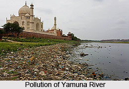
Pollution and Protection of Yamuna RiverPollution in Yamuna River has increased rapidly and the protection of this river includes several governmental steps. Yamuna is unfortunately one of the most polluted rivers in the world, especially in the banks near New Delhi, the capital of India. Almost 57% of the citys waste is dumped into the river. Numerous attempts have been made to clean it; however the efforts have brought few changes. In addition, the water in this river remains torpid for almost 9 months in a year infuriating the situation.

Pollution of Yamuna River
Yamunas water is distinguishable as "clear blue" as compared to silt-ridden yellow of the Ganges. Due to high density population growth, rapid industrialization, today Yamuna is terribly polluted. Delhi alone debouches around 3,296 MLD (million litres per day) of dirt in the river. This makes harms to aquatic life and depletes oxygen level resulting into bad odours and turbidity. The river water is suitable due to pollution, for uses like drinking, outdoor bathing, propagation of aquatic life, irrigation and industrial purposes.

Industrial pollution affects oxygen, temperature & pH etc. Large and medium industrial units - 22 in Haryana, 42 in Delhi and 17 in Uttar Pradesh have been accused as directly discharging and polluting the river Yamuna under the Action Plan area.
Pollution and Protection of Yamuna River Protection of Yamuna River
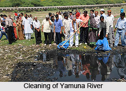
The government of India has prepared elaborate plans to reconstruct and revamp the sewage system and also the drainage system that empty into the river. In the context of river pollution, certain actions of cleaning river have been strictly taken by the Ministry of Environment and Forests (MoEF) of the Government of India (GOI) in 12 towns of Haryana, 8 towns of Uttar Pradesh and Delhi under an action plan called the Yamuna Action Plan (YAP), which is being implemented since 1993 by the National River Conservation Directorate (NRCD) of the Ministry of Environment and Forests.

The Japan Bank for International Cooperation (JBIC) also participates actively in the Yamuna Action Plan in 15 of the above 21 towns, excepting the 6 towns of Haryana included later on the direction of the honourable Supreme Court of India. In August 2009, he Delhi Jal Board (DJB) prompted its plan for resuscitating the Yamuna?s 22 km stretch in Delhi by constructing interceptor sewers.


Share this Article:

Related Articles

More Articles in Geography of India


Geography of Uttar Pradesh
The fourth largest State in India UP is located in the Northern part of India whose area is 2,36,286 sq Kms.
Geography of Maharashtra
Covering an area of 308,000 sq. km, Maharashtra, the third largest state in India.
Geography of Kerala
Geography of Kerala includes plains, hills, valleys and coasts. With the Arabian Sea in the west, the Western Ghats in the east and networked by several rivers, Kerala enjoys diverse geographical features.
Geography of West Bengal
The geography of West Bengal is unique with high peaks of the Himalayan range in the north, the Bay of Bengal in the south and the remaining region is covered with both plains and plateaus.
Geography of Jharkhand
Geography of Jharkhand is comprised of the rich mineral resources and the highly agricultural prospect in this state.
Geography of Sikkim
Geography of Sikkim is characterised by a vast array of magnificent hillock that extends from one corner of the state to the other.
Geography of Meghalaya
The suitable climate, highland plateaus, rivers and the flora and fauna together forms the geography of Meghalaya.
Geography of Mizoram
Mizoram is surrounded by hills, valleys, rivers, waterfalls and lakes. The hills range from 1000 meters to 2000 meters. Rivers, lakes and waterfalls also play major role in forming the land of Mizoram.
Geography of Jammu & Kashmir
Jammu and Kashmir is encompassed by valleys. Some of the dominant valleys of the state are Kashmir Valley, Tawi Valley, Chenab Valley, Poonch Valley, Sind Valley and Lidder Valley etc. Jhelum River is the only major Himalayan River which flows through the Kashmir valley. Indus, Tawi, Ravi and Chenab Rivers are the major ones flowing through the region.
Geography of Daman and Diu
Daman and Diu is situated on the west coast of India and are the smallest union territories of India.
Geography of Goa
Geography of Goa occupies a prime location along the Konkan coastal belt on the western coast of India. The state is bordered by Maharashtra in the north and Karnataka in the south. The Western Ghats in the east contribute to the flora and fauna of Goa.
Geography of Arunachal Pradesh
Geography of Arunachal Pradesh reveals that it is a hilly tract nestled in the foot of Himalayas.
Geography of Kutch
Geography of Kutch District is covering an area of 45,612 km. Kutch District is the largest district in the state of Gujarat.
Geography of Ladakh
Geography of Ladakh mainly comprises the huge Karakoram Range with long stretch of cold desert which mark the region separately from the rest of the states of Indian subcontinent. Surrounded with the mountain ranges from all corners this small region separates Indian subcontinent from rest of the Asian continent.
Geography of Rajasthan
Geography of Rajasthan defines the dry topography with arid climate of the western mountain region.
Geography of Tamil Nadu
The Indian state of Tamil Nadu is located in the Northern hemisphere in the hot zone.