 The Indian subcontinent, located mostly on the Indian Plate, has varied topography. Its topographical features are labeled as unique and distinguished and range from the northern mountains to the coastal plains. Plateaus also form a part of Indian subcontinent. The plateaus of India have briefly been discussed below:
Deccan Plateau
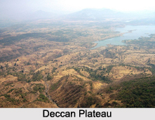
Deccan Plateau is a large plateau in southern India, spreading over eight Indian states. It rises to a height of 100 meters in the north and to more than 1 kilometer in the south. The climate of the region varies from semi-arid in the north to tropical in most of the region with distinct wet and dry seasons. Deccan Plateau is a source of minerals and precious stones.
Chota Nagpur Plateau
Chota Nagpur Plateau of India is located in Jharkhand and also occupies adjacent parts of Odisha, West Bengal, Bihar and Chhattisgarh. This plateau occupies a total area of approximately 65,000 square kilometers. It has an elevation of about 620 meters. Pareshnath Hill is its highest point with an elevation of about 1,350 meters.
Sigur Plateau
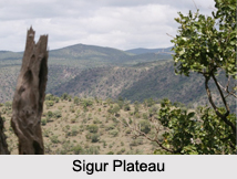
Sigur Plateau, one of the plateaus of India, is located in the north and east of Nilgiri district in the Nilgiri Hills of Tamil Nadu. This plateau is spread over an area of about 778.8 square kilometers. The plateau region is known to experience moderate and pleasant climate. Sigur river valley serves as a crucial micro-habitat for herbivores. Its floral population comprises of tropical dry deciduous forest, thorn scrub forests, dense shola and montane grassland.
 Rohtas Plateau
Rohtas Plateau is located in the south-western part of Bihar. This undulating table land occupies an area of about 800 square miles. Rohtas plateau of India attains a height of about 1,490 ft above sea level at Rohtasgarh. There are a number of waterfalls along this Plateau. Some of them are Devdari Falls, Telharkund Falls, Okharean Kund Falls, etc.
Kolar Plateau
Kolar Plateau is located south of Karnataka. This dry region comprises of scrub vegetation making it suitable for sheep husbandry. The Kolar gold fields are located in this plateau of India. Kolar Plateau contributes in the production of woolen blankets, leather goods, hand loomed silk, etc.
Kaas Plateau
Kaas Plateau is situated about 25 kilometers west from Satara city in Maharashtra. It has the distinction of being a UNESCO (United Nations Educational, Scientific and Cultural Organization) world natural heritage site. It has an elevation of about 1200 meters and is approximately 10 square kilometers in area. Among all the plateaus of India, Kaas plateau serves as a home to various types of seasonal wild flowers and various species of endemic butterflies.
Bhander Plateau
The Bhander Plateau of India is located in the state of Madhya Pradesh. It has an area of 10,000 sq. km. It connects the Deccan Plateau to the south with the Indo-Gangetic Plains and the Chota Nagpur Plateau to the north and east respectively.
Changtang Plateau
The Changtang is a part of the high altitude Tibetan Plateau in western and northern Tibet extending into southeastern Ladakh with vast highlands and giant lakes. From eastern Ladakh, the Changtang stretches approximately 1,600 kilometers east into Tibet.
Karbi Anglong Plateau
Among all the plateaus of India, this plateau is in fact an extension of the Indian Plate in the North Eastern state of India. This area receives maximum rainfall from the Southwest summer Monsoon from June through September. Average height of this plateau varies from 300 meters to 400 meters.
Other Plateaus of India
Some other plateaus of India are Karbi-Meghalaya plateau, Mangi-Tungi Plateau, Mysore Plateau, Shillong Plateau, Tibetan Plateau and Vallam Plateau etc.


