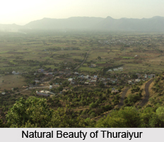
 Pithoragarh also venerated as miniature Kashmir because of its remarkable resemblance to the Indian state of Jammu and Kashmir. This majestic spot snuggles in the beautiful Sour valley, which extends to the length of 8km and broadens till 5km. This valley is perched at an altitude of 1650meters above the sea level. Pithoragarh is a city with a municipal board in the Pithoragarh district in the state of Uttarakhand, India. It was set up as a separate district in 1962 out of Almora district.
This is a comprehensive and enthralling location that creates charm by bestowing varied natural scenic beauties like pouring waterfalls, wonderful glaciers, breathtaking verdant pastures, natural reservoirs, prosperous floridity, serene aura and locales, multi-coloured rainbows. The dense forests around Pithoragarh possess a wide range of wild flowers and animals including peacocks, elephants, tigers, musk deer and snow leopards.
History of Pithoragarh, Uttarakhand
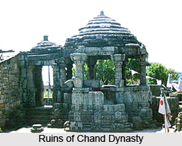
In the year 1364, Pithoragarh was subjugated by the Rajwar of Ukko Bhartpal. Till the 14th century, this kingdom was ruled by three descendants of the Pals. The Pals extended their kingdom over to Askot and ruled from Pithoragarh to Askot. According to a brass plate inscription or Tamrapatra dating back to 1420, the Pal dynasty was uprooted by the Brahm dynasty of Nepal. The Pal dynasty regained their rule after Kshetra Pal overpowered Gyan Chand in a conflicting war. It is believed that Bhartichand, an ancestor of Gyan Chand replaced Pals, the ruler of Pithoragarh after defeating them in 1445. In the 16th century, Chand Dynasty again took control over Pithoragarh and erected a new fort in the year 1790; on the hill where the present girls inter college school is located. Pithoragarh remained a Tehsil under Almora district until it was replaced to a district in the year 1962. Tradition says that during the reign of Chand kings of Kumaon, one Piru also called as Prithvi Gosain, built a fort here and named it Prithvigarh, which with the passage of time got changed into Pithoragarh. Other local legends say that Pithora, a Gurkha King, constructed a fort here and started calling it as Pithoragarh.
Geography of Pithoragarh
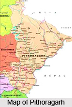
Pithoragarh is the Eastern most Himalayan district of Uttarakhand state, India. It rests in the Sour valley at an altitude of 1650meters and lies 151 km away from Tanakpur. Pithoragarh district located adjoining Tibet and Nepal is a treasure house of attractions for tourists and pilgrims. Pithoragarh lies in the midst of four hills Chandak, Dhwaj, Kumdar and Thal Kedar; it stretches over the southern most part and is flanked to Jhulaghat segregated by the Kali River. Pithorgarh houses in the folds of four Kots viz. Bhatkot, Dungarkot, Udaikot and Unchakot. Pithoragarh is also known as the Gateway to Himalayas because pilgrims trek through this town to reach the celestial Kailash Mansarovar and Om Parvat. Pithoragarh is also affluent in mineral deposits of magnesium ore, copper ore, limestones and slate stone.
 Tourism of Pithoragarh
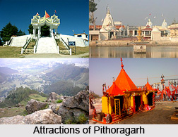
Pithoragarh has almost everything to captivate the nature lover. Beauty drops her image on almost everything whilst bestowing Pithoragarh with assorted natural scenic beauties like driving waterfalls, magnificent glaciers and serene aura and locales.
The Fort
This is a beautiful ancient hill fort that was built up by the Gorkhas in 1789 when they took over the power. It is located at a distance of 300meters from the main town Pithoragarh, now the government building houses the hill fort.
Askot Wildlife Sanctuary
Located in the meadow surroundings of Indo-Nepal border in Pithoragarh, Askot Wildlife sanctuary was established in the year 1986.
Kapileshwar Mahadev Temple
This is a cave temple dedicated to Lord Shiva. This temple is located at a distance of 3km from the city. This is an enthralling spot that offers pleasant views of the surrounding Saur valley and the Himalayan lofty peaks.
Rai Gufa
This is also a cave temple that is dedicated to Lord Shiva and is just one kilometer from Siltham.
Karmakhya Devi Temple
The Chand Rulers were great enthusiasts and builders of temples. Some of their constructed temples ruins lie in Pithoragarh. One such temple is Karmakhya Devi Temple which is located at a distance of 3km from Pithoragarh.
Dhwaj Temple
Dhwaj Temple piled at an altitude of 2,100 meters affords superb panoramic view of the snow-clad peak of the north. It is renowned for the temple dedicated to Lord Shiva and Maa Jayanti. It is located at a distance of 18km on motorable road and 5km on foot.
Thal Kedar
Thal Kedar is a religious center filled with Lord Shiva temples, which is also noteworthy because of its thriving natural scenic beauty. Large fair and fest is held on the auspicious occasion of Shivratri. It lies 16km far from Pithoragarh.
Chandak Hill
This hill is perched at an elevation of 2000 meters at a distance of 7km from the main town Pithoragarh. This splendid location renders a panoramic view of the snow capped Himalayan ranges extending from Trisul-Nandadevi, Panchchuli Group to Mount Appi of Nepal. Mostmanu is a well known Lord Shiva temple located nearby Chandak, where large fair is held every year in the month of September.
Visiting information
The finest time to visit Pithoragarh is between the months of April-June and September-October. The nearest airport is Naini Saini, Pithoragarh located at a distance of 5kms. The nearest railway station is Tanakpur located at a distance of 151kms. Pithoragarh is well connected to all major cities of the state by motorable road.


