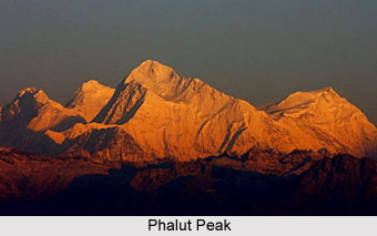
 Phalut or Falut Peak is the second highest peak in the West Bengal state of India. It is also one of the highest peaks of Singalila range. The peak is also well-known for being in the border of Nepal, Sikkim and West Bengal. Scenic beauty, dense greenery at the bottom and forests of various trees are the highlight of Phalut. It is quite popular among the people who love to trek and explore the natural beauty. It is often referred as a "paradise for the lovers of trekking".
Etymology of Phalut
The term Phalut is derived from the Lepcha word Fak-Luk, meaning "Barren Peak".
Location of Phalut Peak
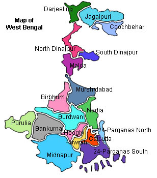
It is located in the Darjeeling district of West Bengal. The peak is positioned at an elevation of 3600 metres above mean sea level and at an altitude of 11,811 ft. It is situated inside the Singalila National Park and is about twenty five kilometres from Rimbik.
Attractions of Phalut Peak
Located at the border of West Bengal and Sikkim and the country of Nepal, Mount Kanchenjunga can be closely viewed from here. Mt. Everest, Mt. Makalu, Mt. Lhotse, Kanchandzonga, Kabru, Kumbhakarna, Mt. Pandim, Mt. Simbho and Three Sisters can also be seen from here. It is about twenty one kilometres from Sandakphu and six kilometres from Molley. Phalut has rhododendron trees of various types that bloom with colourful flowers during April to May. It is home to forests of oaks, chestnut trees, magnolias and silver firs.
Trekking at Phalut Peak
Phalut offers exciting trekking opportunities for trekkers who are on their way to Sandakphu from Darjeeling. Phalut is around 21kms from Sandakphu. Manebhanjan is the base from where the walk actually begins for Sandakphu and then onward to Phalut. Depending on the speed of the trek, the journey takes three to four days to reach Phalut from Manbhanjang. The interesting part of this peak is that the last stretch is actually quite barren in contrast to its lower levels which are surrounded by dense forests.
Connectivity of Phalut Peak
The ideal time to visit Phalut Peak is from April - May for flowers and October - December for scenic view. Phalut is accessible from Gorkhey by foot which is at a distance of sixteen kilometres.