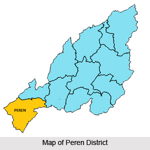
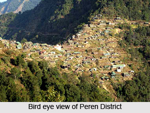
 Peren District is the 11th and the newest district of Nagaland. This district was formed after the bifurcation of Kohima District. Peren Town is the administrative headquarters of Peren District. Peren District has a total area of 2300 sq kms. The altitude of this district varies from 800 metres to 2500 metres above the sea level. Mt. Paona, the highest mountain peak in the district is 2500 metres high and Peren Town is 1445.40 metres above sea level. Peren, Jalukie and Tening are the major towns. Peren District is mainly inhabited by Kuki tribe and Zeliang tribes.
Location of Peren District
Peren District is located between longitude 93 degree east - 94 degree east and latitude 25 degree north - 26 degree north of the Equator. Peren District is bounded by two states and two districts. On the east and south it shares Nagaland`s inter-state boundary with Manipur; on the west also it shares Nagaland`s inter-state boundary with Assam; and on the north and north-east it is bounded by two districts of Nagaland - Dimapur and Kohima, respectively.
Geography of Peren District
Geography of Peren District is basically a strip of mountainous territory having fertile foothill valley plains in north-west and north-east. It occupies the elongated south-western end of the state. The principle rivers and important rivulets that flows through Peren District includes Tepuiki, Mbeiki (Barak), Ntanki, Mungleu, Tesanki, Nguiki, Nkwareu, Techauki, Ngungreu,Tahaiki and Duilumreu (Tributary of Tepuiki). Peren District enjoys Monsoon type of climate. Owing to the elevation of the area and rich vegetation, Peren District enjoys salubrious climate of temperate type. Winters are cold but pleasant and summer season is warm and tolerable.  The mean annual temperature in the hill sector ranges from 18 degree Celsius to 26 degree Celsius (approximately) and in the valley sector, it ranges from 18 degree Celsius to 35 degree Celsius (approximately). Metamorphic rocks, particularly quartzite are the most commonly found rock in the District. Besides, sand stones are abundantly found in Tening Circle. Peren District is rich in natural vegetation. It enjoys the distinction of being one of the few places in Nagaland where virgin forests are still found. Sub-Tropical Mixed Forest characterized by broad-leafed evergreen trees and deciduous trees abounds.
Demography of Peren District
The population of Peren District is entirely tribal. As per 2001 Census, the total population of the district is 96,825 of which male population is 50,001 and female population is 46,823. The literacy rate of Peren District as per 2001 Census is 54 percent, of which male literacy percentage is 32 percent and female literacy percentage is 22 percent. About three-fourth of the population are involved in agriculture. Rice is the staple food crop cultivated in the district.
Tourism in Peren District
Peren District is a remote hilly area covered with luxuriant vegetation and unique forests, cool and bracing climate. Scenic beauty of the terrain, enchanting rivers and rivulets, presence of wide variety of wild animals and birds, offer a magnificent and pleasant tourism experience. Moreover, the rich cultural heritage of the Zeliangs including festivals and dances are added attractions for the tourists. Places of interest at this district include historical places like Mt. Kisa at Nzauna village situated at the southernmost end of the district and the caves at Puilwa village, and Ntanki National Park and more.
Peren District has one Mini Hydro Project at Duilumreu, Poilwa.


