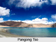
 Pangong Tso, also referred to as Pangong Lake, is a land locked lake in the Himalayas, famous for its besotting beauty and the absolute picturesque landscape it thrives in.
Location and Area of Pangong Tso
Pangong Lake, referred in Tibetan as Pangong Tso meaning high grassland lake, is situated on the Changtang Plateau in eastern Ladakh in the Himalayan region, at an altitude of 4,350 metres (14,270 feet) above mean sea level.
The lake stretches 134 kilometres in length and upto 5 kilometres in width, covering an overall area of 604 square kilometres. The lake"s maximum depth is 100 metres (328 feet). It is the largest lake in Ladakh and one of the largest brackish water lakes in Asia, extending from Ladakh in India to Tibet in China. It is also the highest salt water lake in the world. Almost two-thirds of the lake"s stretch is in Tibet.
Flora in Pangong Tso
The saline waters of the Pangong Lake make very low vegetation grow around it, with only few species of scrub and perennial herbs found growing in the marshy land around the lake.
Faunal Attractions in Pangong Tso
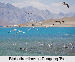
The Pangong Lake is a breeding place for varied species of birds, including many migratory ones. Numerous ducks and gulls can be spotted on the lake waters floating over the surface. Rare black-necked cranes, Brahmini ducks, bar-headed goose and several other migratory birds are seen near the lake during summers. Among the wildlife species, the Ladakhi marmots, rodent-like creatures growing up to the size of a small dog and the kiang are common in this region. There are no reported fish or aquatic species in the lake, except for a few small crustaceans.
Aesthetic Appeal of Pangong Tso
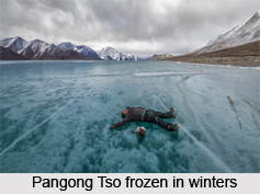
The Pangong Tso is nature"s paradise far distant from the hustle-bustle of city life, sprawling in the backdrop of a spectacular landscape of mountains that appear strikingly brown under the vast clear open skies. One of the most alluring features of this lake is the changing tints of its azure blue waters, sparkling in varying shades of blue, green, purple, and violet. The crystal clear waters and the landscape all around is a real treat to the eyes. The lake basin is rich in mineral deposits, which accumulate every year by the melting snow from the mountains. A narrow ramp-like formation of land running into the lake is a favourite spot among tourists and photographers. Despite being brackish, the lake remains frozen in winters, surrounded by snow-capped mountains. During this time, an ice skating gala fest is organised over the lake"s surface, in which a number of ice skaters and skiers from different parts of the world indulge, while also experiencing the culture of the native locals.
The lake"s beauty has attracted a number of popular Indian filmmakers to shoot scenes of their movies in the site.
Access to Pangong Tso
The Pangong Lake is accessible from Leh with a five-hour drive along the Chang La pass, the third highest motorable road in the world at 5300 metres elevation. Army sentries and the beautiful Ladakh countryside are seen on this route. The first glimpse of the tranquil bright blue waters of the lake and the lakeshore remains etched in the minds of visitors. Leh in turn is well connected by flights from Delhi.
Accommodations near Pangong Tso
 Tents are the only option for staying close to the Pangong Lake on its shores. Among the other limited stay options, the Eco Huts for camping are offered in Lukung, the closest Indian village to the lake. Basic accommodation facilities are also available in Spangmik village along the road to the lake. It is the only place around to have a hotel and also offers luxury tents. Tangste village about 32 kilometres from the lake has more number and better quality of stay options.
Season to visit Pangong Tso
The time to take a tour to the Pangong Lake is from June to September, during the summers. The winters are too harsh and inconvenient time to visit and the lake remains frozen. The spectacular lakeside is open to tourists only in the peak season between May to September.
Pangong Lake is a vulnerable border area lying along the Sino-Indian Line of Actual Control; therefore, an Inner Line Permit is required by tourists to visit the lake. Indian nationals can visit with individual permits while foreign nationals must obtain group permits for minimum three persons, accompanied by an accredited guide. The tourist office in Leh issues these permits for a small fee. For security reasons, boating in the Pangong Tso is prohibited by India.
Recent Shrinkage of Pangong Tsu
Strand lines above the current lake level reveal a 5 metres (16 ft) thick layer of mud and laminated sand, indicating that the lake has recently shrunk in geological scale.
The Pangong Tso is up for consideration to be included in the Ramsar Convention wetlands of international importance. It will be the first trans-boundary wetland in South Asia under this convention.


