 Palamu District is an administrative district of Jharkhand with its administrative headquarters at Daltonganj. Daltonganj has taken its name after colonel Dalton, commissioner of Chota Nagpur Plateau in 1861. Palamu District lies between 23 degrees 50 minutes and 24 degrees 8 minutes north latitude and between 83 degree 55 minutes and 84 degree 30 minutes east longitude. It occupies an area of 5043.8 sq kms. The distance between Daltonganj and Ranchi is 165 km. Old Palamu District is divided in three districts namely Palamau, Garhwa District andLatehar District. Palamu District is bounded by the Son River in the north which separates it from Rohtas District and by district Aurangabad (Bihar), by Chatra District and Hazaribagh in its east, by Latehar District in the south and in the west by Garhwa District and Chhattisgarh.
History of Palamu District
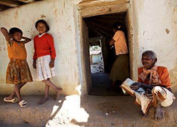
Early history of Palamu District is not concrete due to lack of solid evidences. It is, however certain that Kharwar Tribe, Oraon Tribe and Chero Tribe, the three aboriginal races practically ruled over the region. Kharwar tribes claim to be Suryavanshi Kshatriyas. They trace their decent from Ajanagara or Ayodhya. Karusa was assigned the eastern territory. The descendants of Karusa were called Karusas who subsequently came to be known as Kharwars. According to tradition they were the rulers of Rohtasgarh Fort in Rohtasgarh. History of Palamu District does not provide much evidence about the Chero Tribe who also ruled this region. History of Palamu District is quite vague. According to some historical account, the name of this region was derived from the Hindi word `palana`, that means "a place of refuge."
Geography of Palamu District
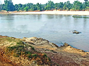
Geography of Palamu District includes forests and major streams. The climate of this district is dry. The year can be divided in to three main seasons. The cold season from November to March, hot season from March to May and monsoon season from June to September, October is a transitional month between monsoon and winter seasons. Maximum temperature can be as high as 47 degree Celsius on individual days. Relative humidity is generally lower in the afternoons than in the mornings. Winds are light to moderate during the winter and summer months, the speed being higher in the afternoons. The directions from which winds blow are variable especially during the monsoon season. The general line of drainpipe is from south to north towards Son River, which forms parts of the northern boundary of the district. The principal rivers are Koel River and its tributaries, Auranga and Amanat. There are several other smaller streams. Further north these rivers have deep sandy beds, into which the water sinks out of sight in the hot weather, percolating through the soft sand.
 Tourism in Palamu District
Tourism of Palamu District includes several places of interest including reserve forests. The natural beauty of the district adds charm to the travelling experience of the visitors. The major attractions of this district are Netarhat, Shahpur, Palamu and Betla. Betla National Park is known for its diverse wild life species. These places are worth visiting.
Palamu District can be easily accessed by roadways, railways or airways from Daltonganj and from Ranchi.


