Home > Indian History > Geography of India > Palair Lake
Palair Lake
Palair Lake is an artificial lake in Telangana, located in the Khammam District of Andhra Pradesh.

Share this Article:

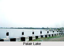
Palair Lake, Khammam District, TelanganaPalair Lake is a man made lake in Telangana. This lake is located in Khammam district of Telangana. Khammam is a district in Telangana. In this district about 19.81 percent were urban settlement according to 2001 census.

Khammam city is the district headquarters of Telangana. The present name of Khammam is derived its name after a local hill, which was called as "Stambhadri". The city was called with different names starting with Stambhadri, Kambhadri, Kambham mettu, Khammam mettu and then finally as Khammam.

Tourism in Palair Lake
Palair Lake in Telangana is one of the beautiful lakes in India. Palari Lake is part of the Palair Village that lies in the Kusumanchi Mandal within the Khammam district. The lake lies at about 30 kilometres from the main city of Khammam

The water of Palair Lake in Telangana is used for irrigation purposes from the medieval times. Palair Lake in Telangana is a famous spot for fish farming. Palair Lake is a very famous tourist attraction of Khammam District. It is because; it offers other water sports as well as adventure sports activities.

Palair Lake in Telangana also has many varieties of prawns and fresh water fishes. The fishing cultivation is originated for the national and international level tourists. Near Palair Lake in Telangana, there are many stalls to offer the delicacies for the tourists. Another attraction near Palair Lake in Telangana is the Wyra Lake which is another good picnic spot for the weekenders. The travellers coming to the city of Khammam can club their visits to these places together to make the most of their trips. To attract the tourists, the Government of Telangana and the Municipal Corporation of Khammam District host the Stanmbhadri Sambaralu, the festival of Khammam District near Palair Lake. This festival is a water-based adventure and entertainment event.

Visiting Information
Palair Lake in Telangana is easily accessible by roadways and railways. This man-made lake is actually a balancing reservoir for the left canal, which is called Lal Bahadur Canal. This Lal Bahadur Canal was built as part of the Nagarjuna Sagar Water Project. Palair Lake in Telangana has been built over an area of 1748 hectares of land. It has a capacity of storing 2.5 TMC water specially used for agriculture and other economic purposes.


Share this Article:

Related Articles

More Articles in Geography of India


Geography of Uttar Pradesh
The fourth largest State in India UP is located in the Northern part of India whose area is 2,36,286 sq Kms.
Geography of Maharashtra
Covering an area of 308,000 sq. km, Maharashtra, the third largest state in India.
Geography of Kerala
Geography of Kerala includes plains, hills, valleys and coasts. With the Arabian Sea in the west, the Western Ghats in the east and networked by several rivers, Kerala enjoys diverse geographical features.
Geography of West Bengal
The geography of West Bengal is unique with high peaks of the Himalayan range in the north, the Bay of Bengal in the south and the remaining region is covered with both plains and plateaus.
Geography of Jharkhand
Geography of Jharkhand is comprised of the rich mineral resources and the highly agricultural prospect in this state.
Geography of Sikkim
Geography of Sikkim is characterised by a vast array of magnificent hillock that extends from one corner of the state to the other.
Geography of Meghalaya
The suitable climate, highland plateaus, rivers and the flora and fauna together forms the geography of Meghalaya.
Geography of Mizoram
Mizoram is surrounded by hills, valleys, rivers, waterfalls and lakes. The hills range from 1000 meters to 2000 meters. Rivers, lakes and waterfalls also play major role in forming the land of Mizoram.
Geography of Jammu & Kashmir
Jammu and Kashmir is encompassed by valleys. Some of the dominant valleys of the state are Kashmir Valley, Tawi Valley, Chenab Valley, Poonch Valley, Sind Valley and Lidder Valley etc. Jhelum River is the only major Himalayan River which flows through the Kashmir valley. Indus, Tawi, Ravi and Chenab Rivers are the major ones flowing through the region.
Geography of Daman and Diu
Daman and Diu is situated on the west coast of India and are the smallest union territories of India.
Geography of Goa
Geography of Goa occupies a prime location along the Konkan coastal belt on the western coast of India. The state is bordered by Maharashtra in the north and Karnataka in the south. The Western Ghats in the east contribute to the flora and fauna of Goa.
Geography of Arunachal Pradesh
Geography of Arunachal Pradesh reveals that it is a hilly tract nestled in the foot of Himalayas.
Geography of Kutch
Geography of Kutch District is covering an area of 45,612 km. Kutch District is the largest district in the state of Gujarat.
Geography of Ladakh
Geography of Ladakh mainly comprises the huge Karakoram Range with long stretch of cold desert which mark the region separately from the rest of the states of Indian subcontinent. Surrounded with the mountain ranges from all corners this small region separates Indian subcontinent from rest of the Asian continent.
Geography of Rajasthan
Geography of Rajasthan defines the dry topography with arid climate of the western mountain region.
Geography of Tamil Nadu
The Indian state of Tamil Nadu is located in the Northern hemisphere in the hot zone.