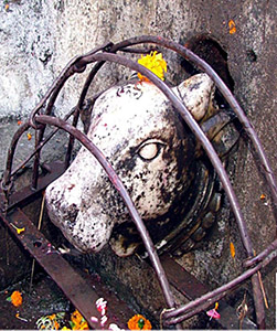
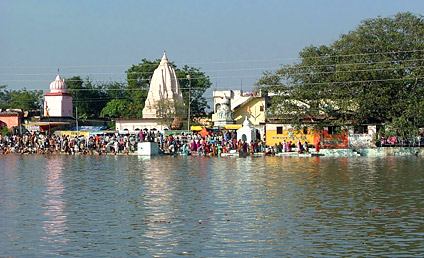
The Tapti River originates in the Betul district from a place called Multai. The Sanskrit name of Multai is Multapi and the term means the origin of Tapi Mata or the Tapti River. The Tapi River in Thailand was named after India`s Tapti River on August 1915. According to Hindu values, the Tapi River is considered to be the daughter of Lord Surya. There is a Purana dedicated to the virtues of Tapi, which praises the river as holier than all other rivers including the Ganges. The Tapi purana has mentioned that bathing in the Ganges, beholding Narmada and remembering Tapi, any person can be delivered from all sins.
 The origin of Tapti River is at the Satpura range of Betul district in the central Indian state of Madhya Pradesh. It is supposed to originating from small pond at a small town known as Multai, originally known as Multapi or the origin spot of Tapti. The Betul District encompasses an area of 10043 km² and population is around 13,95,175 as per 2001 census. The place Multapi has become a tourist spot and also a place for pilgrimage for the worshippers of Tapti River. Density of the population in this town is 138/km². Betul district is actually rich in tribal population. The tribal population of the district as per 2001 census is 5,49,907. The main tribes inhabiting the district are Gonds and Korkus. The other castes of tribe in this place include Kurmis, Bhoyars, Mehras, Kunbis, Chamars, Banias and Rajputs.
The elevation of the origin of Tapti River above the sea is about 2000 ft. The area is essentially a highland tract, divided naturally into three distinct portions, differing in their superficial aspects, the character of their soil and their geological formation is similar throughout the upper course of the river. The northern part of the district forms an irregular plain of the sandstone formation. The area is a well-wooded tract, in many places stretching out in charming glades like an English park, but it has a very thin population and sparsely cultivated land.
In the extreme north of the originating point of River Tapti, a line of hills rises unexpectedly out of the great plain of the Narmada valley. The central tract alone is a concentrated region of rich soil, well watered by the Machna and Sampna rivers, almost entirely cultivated and studded with villages. To the south lies an undulating plateau of basaltic formation; along which rises the springs of the Tapti River at it`s highest point. These springs extend over the whole of the southern direction of the district, and finally merges with the wild and broken line of the Ghats, which goes down and meet with the plains. This tract comprises a sequence of stony ridges of trap rock, enclosing valleys or basins of fertile soil. Here cultivation is not done in most of the parts, except where the shallow soil on the tops of the hills has been turned to account.
 The climate of Betul or the place of Tapti River`s origin is fairly healthy. Its height above the plains and the neighborhood of widespread forests moderate the heat, and render the warmth pleasant throughout most of the part of the year. During the winter season the temperature at night falls below the freezing point. Rarely hot wind is felt before the end of April. The summer nights are comparatively cool and pleasant. During the monsoon the climate becomes very damp, and at times even cold and raw, bulky clouds and mist envelops the sky for many days together. The average annual rainfall of the place is 40 in.
Betul district is rich in forests and biodiversity, specially the area of Multapi. Main timber species of Betul Forest is Teak. Many more types of trees including the Haldu, Saja, Dhaoda are also found in ample. Many medicinal plants are available in the forest areas of Betul. Huge amount of minor forest produce serve commercial purposes. The Tendu leaves, Chironji, Harra, Amla are also collected in huge quantity from the forests of Betul. Asia`s biggest wood depot is believed to be in Betul.
The major rivers flowing in the district are Ganjal River, which is a tributary of Tapti River, Morand River and Tawa River. These are the tributaries of Narmada River.


