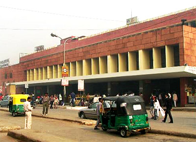
 The Northern Railway is one of the important Railway Zones under the administration of Indian Railways (IR). Northern Railway boasts of its largest route track expanding about 6807 km. The divisions of Northern Railway are amongst the cities of Delhi, Lucknow, Ferozpur, Moradabad and Ambala. The headquarters of Northern Railway is at Baroda House, New Delhi, with Divisional headquarters at Ambala, Delhi, Firozpur, Lucknow and Moradabad. This branch of Indian railway serves eight states, namely Delhi, Haryana, Himachal Pradesh, Jammu and Kashmir, Punjab, Uttarakhand and Uttar Pradesh and the Union Territory of Chandigarh.
In 1952, the 3 divisions of East Indian Railway, the Jodhpur Railway, the Eastern Punjab Railway and Bikaner Railway were combined to form Northern Railway. At present, the Northern Railway caters to the passengers of the Indian states of Punjab, Uttarakhand, Jammu and Kashmir, Uttar Pradesh, Haryana, Delhi, Himachal Pradesh. Other than this, the Northern Railway also serves the Union Territory of Chandigarh. Northern Railway has introduced the Route Relay Interlocking (RRI) systems in the major rail stations, Interactive Voice Response System (IVRS), Reservation Availability Position Information Display (RAPID), Self Dial Telephone Reservation Enquiry Booths (I ASK), Automatic Teller Machines (ATM) and many other facilities. Other than these ticket related facilities, Northern Railway also facilitated its passengers by providing plush retiring rooms, computerized passenger reservation system, money exchange facilities, catering facilities, online reservation facilities, electronic display system and PNR Status online checking facilities.
On March 3, 1859, the first Railway Line in North India was laid between Allahabad and Kanpur. This was followed, in 1889, by the Delhi - Ambala - Kalka line. From these unassuming beginnings, the Indian Railways eventually grew to become the world`s largest network under a single management. Northern Railway was previously a grand eight-divisional zone- comprising of Allahabad, Bikaner, Jodhpur, Delhi, Moradabad, Ferozpur, Ambala and Lucknow embracing most of North India. After the re-organisation of zones in 1952, the Northern Railway is now a vibrant five-star constellation, namely in Delhi, Moradabad, Ferozpur, Ambala and Lucknow.
Shatabdi Express, Rajdhani Express, Mussorie Express, Sadbhavna Express and Swaraj Express are some of the notable trains of Northern Railway. Northern Railway also caters the tourists of north India heavily; some of the tourist hubs of India, served by Northern Railway are Pahankot, Ludhiana, Shimla, Jammu, Delhi, Lucknow, Chandigarh, Amritsar, Haridwar and many others.
Northern Railway introduced the first diesel and electric locomotive simulators in India at the Tughlakabad and Kanpur locomotive sheds, thus helping to upgrade the skills of the working and new drivers, providing them training for high speed train operation. Diesel shed, Tughlakabad has the characteristic of being the first diesel shed to get 14000 certification on Indian Railway. Other diesel sheds and workshops of Northern Railway are also going for ISO-14000.
For enhancing efficiency and safety in the operations of Northern Railway, modern signaling plays a vital role. The progress from a rudimentary interlocked system to a Route Relay Interlocked system has been a historical step that solved the problem of fog in north India. Northern Railway is equipped with 40 RRIs, which includes Delhi Main RRI, which is the largest RRI System in the world, a fact that is licensed by the Guinness Book of Records. Northern Railway has been the pioneer in innovation and modernization. The innovative path of technological advancements and innovations on Indian Railways are omnipresent all-over India.


