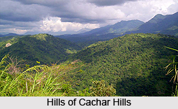
 Cachar Hills District is the administrative districts of Assam with its headquarters located at Haflong. Cachar Hills District is described as the hilliest and undulated districts of Assam. It occupies an area of 4890 sq kms.
Location of Cachar Hills District
Cachar Hills District is located between latitudes 25 degree 3 minutes north and 25 degree 47 minutes north and longitudes 92 degree 37 minutes east and 93 degree 17 minutes east.
History of Cachar Hills District
As per the history of Cachar Hills District after the commencement of the Constitution of India, North Cachar Hills in 1951, ceased to be a part of Cachar District. According to the provision of sixth schedule, two special councils were created namely Cachar Hills District Council and Mikir Hills District Council. Cachar Hills District Council was established in office on 19th April, 1952. In the year 1970, state government declared Cachar Hills District an independent administrative district.
Geography of Cachar Hills District
Cachar Hills District is situated at southern part of Assam. This district is bounded by Nagaland and Manipur in the east, Cachar District in the south, Meghalaya and some parts of Karbi Anglong District in the west and another part of Karbi Anglong and Nagaon District in the north. A major portion of the district is covered by hills. The main range is Borail of which `Thumjang` is the highest peak at 1866 metres and Hempeupet is the second highest peak at 1748 metres. The other main range of the district is Khartheng range from Dittokcherra to Garampani. The main rivers are Kapili, Dehangi, Diyung, Jatinga, Jenam, Mahur and Langting. Diyung River is the longest river with a length of 240 kms.Climate condition of Cachar Hills District is also not uniform. Annual average rainfall varies from 2200 mm to 2700 mm. At this district, rainfall is heavy during May to September, but it is not evenly distributed throughout the district. Average mean maximum temperature varies from 24 degree Celsius to 30 degree Celsius. The average mean minimum temperature varies from 10 degree Celsius to 14 degree Celsius. Further, average relative humidity ranges from 73 percent to 84 percent.
 Demography of Cachar Hills District
As per 2001 Census the average of total population of Cachar Hills District is 1, 86,189 that is near about 7 per cent of the total population of the state. The population of the district comprises various tribes and races having their indigenous dialect, culture, customs and usages. Apart from various tribes, non-tribal groups also account for a sizable percentage of the total population of North Cachar Hills District. Among the various tribes, the prominent ones are Dimasa Tribe, Zeme, Hmar Tribe, Kuki Tribe, Baite Tribe and Hrongkhols Tribe.
Education in Cachar Hills District
The literacy rate in Cachar Hills District is around 69 percent as against the state average of 64 percent. Female literacy rate is 59.40 percent and male literacy rate is nearly 76.59. At this district, there are a number of Arts and Science colleges, high schools, teachers training institutes and industrial training institute.
Economy of Cachar Hills District
Economy of Cachar Hills District is agrarian in character. This district is predominantly a forest area and agricultural practices of paddy cultivation are done in the plain terrain areas. Agriculture in the district mainly depends upon the rainfall. The net area irrigated under net area sown is 6 per cent that is much below the state`s average. Dairying and rearing of cow and buffalo is a common place practice of the tribal population. Dairying and rearing of cow and buffalo is a common practice of the tribal population of North Cachar Hills District. Per capita income of the district is low when compared to state per capita income, which is due to low productivity in agriculture and unemployment and under employments. Cachar Hills District also has proper healthcare infrastructures. It has hospitals as well as community health centres.
Tourism in Cachar Hills District
The major tourist attractions of Cachar Hills District include Haflong Town, Maibang (Stone house and temple of Kachari king and other ruins of the kingdom are the main attractions of the place), Jatinga (a place of bird attraction and attraction), Umrangso and Mahur.


