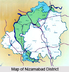
 Nizamabad district lies in the north-western part of Telangana. The early name of the district was Indhrapuri or Indhur and the district was formed in the year 1905. The region of Nizamabad had been under the domination of Chalukyas, Tughlaks and the Nizams of Hyderabad. The word Nizamabad has been derived from two words Nizam and Abad. The word Abad was a title which was used for the rulers of Hyderabad.
Geography of Nizamabad District
The global location of Nizamabad is 18-5 degree and 19 degree north latitudes and 77-40 degree and 78-37 degree of east longitudes. The district is spread across an area of 7956 square kilometers. Nizamabad has been divided into 36 mandals under 3 Revenue Divisions. The boundaries of the district are as follows Karimnagar district in the east, Medak district in the south, Nandhedu district of Maharashtra in the west and Adilabad district in the north. The distance of Nizamabad from the sea coast is quite far.
 As far as climate is concerned it has a tropical climate which widely varies all over the district. The maximum temperature in the district can be as high as 47 degrees centigrade and in the winter months the temperature can be as low as 5`C. The annual rainfall in the district is 1000 mm and most of the rain comes from the south-west monsoon winds. Forest occupies around 170,000 hectares of land in the district of Nizamabad.
Demography of Nizamabad
According to the census of 2001, the population in the district of Nizamabad was 2,345,685. The density of population in the area is 294 persons per square kilometer. The literacy rate in the district is 56.26 percent. The people of Nizamabad are mostly from the rural areas.
As far as education in the district is concerned it has many schools which cater to the primary and secondary education of the students. There are also some colleges providing undergraduate as well as post graduate degrees to the students. The government has also set up a few vocational institutes in the district.
 Economy of Nizamabad
Agriculture is the most important occupation for the people of Nizamabad. Almost 80 percent of the population is engaged in agriculture. As a result maximum economic revenue in the district comes from agriculture. The crops which are commonly grown in the region are paddy, Maize, Turmeric, Cotton, Sugarcane, Groundnut, Sunflower and pulses etc. Forests also accounts as one of the major economic resource for the district of Nizamabad. Apart from the natural resources some industrial establishments in the area are the Bodhan Sugar Factory, some confectionaries and a few alcohol units also add to the economic activity of the district.
Tourism in Nizamabad District
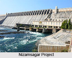
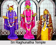
Nizamsagar Project and the Sri Ram Sagar Project are two important place of tourist interest in the district of Nizamabad. The places of historical interest in the district are Domakonda Fort and the Koulas fort. There are also some places in the district which are of religious interest for the tourist as well as the inhabitants of Nizamabad, they are Sri Raghunatha Temple, Dichpally Ramalayam, Sree Neela Kanteshwara Temple, Limbadri gutta and Badapahad. Bedides the religious places which are an integral part of the district, there are also some picnic spots in Nizamabad. These picnic spots like the Alisagar, Ashoksagar and the rock formations of Armoor draw tourists in large numbers.


