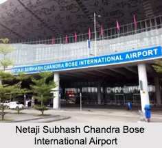
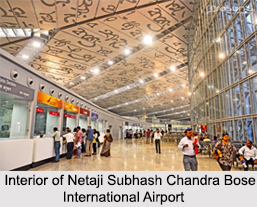
 Netaji Subhash Chandra Bose International Airport is situated in Dum Dum, West Bengal, near Kolkata (Calcutta) serving the Kolkata metropolitan area. Also known as "Kolkata Airport", this airport was initially named “Dum Dum Airportâ€. Afterwards, it was renamed in the honour of the illustrious Bengali patriot Netaji Subhash Chandra Bose. The airport is controlled and operated by the Airports Authority of India (AAI).
Netaji Subhash Chandra Bose International Airport is situated at a distance of 17 km from the city centre. Spread over an area of 2,460 acres, Kolkata Airport is the largest in eastern India and one of only two international airports operating in West Bengal, the other being in Bagdogra. It is the fifth busiest airport in India in respect of aircraft movement after Delhi, Mumbai, Bengaluru and Chennai. Netaji Subhash Chandra Bose International Airport is considered one of the top four airports in the country. It has also bagged the honour of handling roughly 250 flights a day. In 2014 and 2015, Kolkata Airport won the titles of Best Improved Airport in the Asia-Pacific region by the Airport Council International.
 History of Netaji Subhash Chandra Bose International Airport
Netaji Subhash Chandra Bose International Airport has earned a distinguished place in the history of world aviation. In 1924, KLM Royal Dutch Airlines commenced scheduled stops at Calcutta (now Kolkata), as part of their Amsterdam to Batavia (now Jakarta) flight. Five US Air Force planes had landed in Calcutta (Kolkata) as part of the first round-the-world flight expedition in 1924.
In 1929, Bengal Air Transport Company Limited started the Calcutta to Siliguri flights for the very first time. In 1930, Air Orient commenced scheduled stops at Calcutta (now Kolkata), as part of their Paris to Saigon (now Ho Chi Minh City) flight. In 1933, Imperial Airways introduced regular London – Calcutta service.
In 1934, the China National Aviation Company, started flights on the Shanghai-Hong Kong-Chungking (now Chongqing)-Calcutta (now Kolkata) route, as a link to the San Francisco-Shanghai Clipper route. The China National Aviation Company moved their headquarters to Calcutta in 1942. Calcutta remained operational hub of the airline until the end of the Second World War. In 1952 British Overseas Airways Corporation (BOAC) introduced the first jet service to India that connected London and Calcutta, using the de Havilland Comet.
In 1963, Japan Air Lines connected India with Japan as part of the Silk Route service. Calcutta became its sole Indian destination. In 1964, Indian Airlines introduced the first domestic jet service in India on the Calcutta – Delhi route using the Caravelle jets. India"s first dedicated cargo terminal was opened in 1975 at Kolkata Airport.
In 1995, a new domestic terminal was opened and the airport was renamed in honour of Netaji Subhas Chandra Bose. In 2000, a new international arrival hall was opened. In 2006 Netaji Subhash Chandra Bose International Airport was connected to the sub-urban railway system. Thus, it became the first airport in India to be accessible by a mass rapid transport system.
Runways at Netaji Subhash Chandra Bose Airport
Netaji Subhash Chandra Bose International Airport has two parallel runways – 19 L/R. The primary runway 01R/19L has a capacity of 35 flights per hour and is used for takeoffs and landings. The secondary runway 01L/19R has a capacity of 15 flights per hour and is used mostly for the purpose of a taxiway.
Terminals at Netaji Subhash Chandra Bose International Airport
Netaji Subhash Chandra Bose International Airport has three terminals – a domestic terminal, an international terminal and a cargo terminal. The existing international terminal and domestic terminal were integrated into a new integrated L-shaped terminal in 2013. It has six levels and can handle 20 million passengers a year.
Connectivity to Netaji Subhash Chandra Bose International Airport
Netaji Subhash Chandra Bose International Airport has a facility of prepaid taxis and air-conditioned buses that connect it to the city. Kolkata Airport is also connected to the Kolkata Suburban Railway system. It was the first airport in India to have such a connection, which opened in 2005. However, due to poor patronage and plans to replace it with a Metro Rail System, the railway line closed in 2016.


