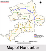
 Nandurbar is a city in Maharashtra. It is a municipal council in Nandurbar district in Maharashtra. The northern boundary of the district is defined by the great Narmada River.
Location of Nandurbar
Nandurbar, the city in Maharashtra is located at 21.37 degree North and 74.25 degree East. Nandurbar has an average elevation of 210 metres (688 feet).
Geography of Nandurbar
The district headquarters is located at Nandurbar city. Nandurbar district occupies an area of 5034 square kilometers and has a population of 1,311,709 of which 15.45 percent is urban (as of 2001). Nandurbar in Nandurbar district is bounded to the south and south-east by Dhule district, to the west and north is the state of Gujarat, to the north and north-east is the state of Madhya Pradesh.
Administration of Nandurbar
Nandurbar of Maharashtra is an administrative district in the northwest corner (Khandesh region) of western part of India. On 1st July 1998, Dhule was bifurcated as two separate districts now known as Dhule District and Nandurbar District.
Demography of Nandurbar
According to the Population Census in the year 2001, Nandurbar had a population of 94,365. The males constitute 52% of the population and females 48%. Nandurbar has an average literacy rate of 72%, higher than the national average of 59.5%. The male literacy is 78%, and female literacy is 65%. In Nandurbar, 12% of the population is under 6 years of age.
Tourism in Nandurbar
Nandurbar has mainly hilly region and have Toranmal which is the second hill station after Matheran in Maharashtra. Near Nandurbar, there flows Tapi River is located at 12 km from city. In Nandurbar, there adds the beauty of the nature. It is the popular weekend gateway in Western Ghats Mountain Region of India. Narmada river forms the boundary in Nandurbar on the northern and north-eastern side. It is well known as the tribal area. One can see the tribal lifestyle while visiting this region.
Visiting Information
Nandurbar is served by a station on the Indian Railways network. Also ST buses are available. Nandurbar is connected to Madhya Pradesh and Gujarat by state highways.


