Home > Indian History > Geography of India > Najafgarh Lake
Najafgarh Lake
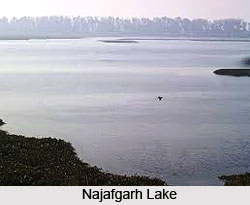
Najafgarh Lake is the fresh water lake in Delhi. This lake now serves an eco tourism spot in South west of Delhi.

Share this Article:

Najafgarh Lake, South West DelhiNajafgarh Lake is fresh water lake, located in South West Delhi. This fresh water lake was connected with Yamuna River by a natural "nullah" or drain called the Najafgarh nullah.

Najafgarh Lake is now widened after 1960, when Flood Control Department of Delhi took the project to save Delhi from flood. The rain water accumulating in Najafgarh Lake has been recorded to have occupied more than 300 square kilometres or 120 square miles.

Najafgarh Lake is now serving as ecotourism site in Delhi. With recent advancement in ecological understanding, Najafgarh Lake protected the urbanisation of South West Delhi and its neighbourhood from devastating flood.

Najafgarh Lake, recorded as wetland ecosystem area, is the abode of several migratory birds and local birds. Najafgarh Lake came to be recognised as an important wildlife habitat after a local naturalist studying the area during 1986-87 to 1988-89.

Najafgarh Lake is a very rich wetland ecosystem flourished with rich local and migratory bird life. On the surrounding lands of Najafgarh Lake, there is plenty of local wildlife. In the British colonial period, large hunting parties of local and British colonial elites descended on the lake yearly. At that time, the local villagers were employed as guides and assisted with the camping duties in the hunting camps. The endangered species like famous Pink-headed Ducks and the Siberian crane are the main visitors in this lake, which adds the beauty.

Najafgarh Lake or Najafgarh nullah has been much widened over the past decades. Now the lake has thick mud embankments on both its sides to channel the waters and protect Delhi from floods. These embankments have been planted with thick forest cover which serve as a much needed habitat for remnant local wildlife occurring in nearby and surrounding farmlands including common foxes, jackals, hares, wild cats, nilgai, porcupines and various reptiles and snakes including the dreaded cobras. Many local birds and the migratory birds as well roost and nest in the urban forestry.

The Delhi Tourism Department had identified this site for Chhawla Water World and Ecopark development. A number of local and migratory birds have been observed at the upstream location of Najafgarh drain from Chhawla up to Dhansa regulator. The water level of this lake is maintained by the Irrigation and Flood Control Department, New Delhi.

Chhawla is located on Bijwasan-Najafgarh Road at about 10 kilometres from Gurgaon National Highway-8 on Rajokri crossing. The catchment area of Najafgarh Lake spreads in Delhi-Gurgaon border located 1 to 2 km distance from Jhatikra. Najafgarh Lake is the largest surface water body in Delhi, spread over in an area of 6 kilometres.


Share this Article:

Related Articles

More Articles in Geography of India


Geography of Uttar Pradesh
The fourth largest State in India UP is located in the Northern part of India whose area is 2,36,286 sq Kms.
Geography of Maharashtra
Covering an area of 308,000 sq. km, Maharashtra, the third largest state in India.
Geography of Kerala
Geography of Kerala includes plains, hills, valleys and coasts. With the Arabian Sea in the west, the Western Ghats in the east and networked by several rivers, Kerala enjoys diverse geographical features.
Geography of West Bengal
The geography of West Bengal is unique with high peaks of the Himalayan range in the north, the Bay of Bengal in the south and the remaining region is covered with both plains and plateaus.
Geography of Jharkhand
Geography of Jharkhand is comprised of the rich mineral resources and the highly agricultural prospect in this state.
Geography of Sikkim
Geography of Sikkim is characterised by a vast array of magnificent hillock that extends from one corner of the state to the other.
Geography of Meghalaya
The suitable climate, highland plateaus, rivers and the flora and fauna together forms the geography of Meghalaya.
Geography of Mizoram
Mizoram is surrounded by hills, valleys, rivers, waterfalls and lakes. The hills range from 1000 meters to 2000 meters. Rivers, lakes and waterfalls also play major role in forming the land of Mizoram.
Geography of Jammu & Kashmir
Jammu and Kashmir is encompassed by valleys. Some of the dominant valleys of the state are Kashmir Valley, Tawi Valley, Chenab Valley, Poonch Valley, Sind Valley and Lidder Valley etc. Jhelum River is the only major Himalayan River which flows through the Kashmir valley. Indus, Tawi, Ravi and Chenab Rivers are the major ones flowing through the region.
Geography of Daman and Diu
Daman and Diu is situated on the west coast of India and are the smallest union territories of India.
Geography of Goa
Geography of Goa occupies a prime location along the Konkan coastal belt on the western coast of India. The state is bordered by Maharashtra in the north and Karnataka in the south. The Western Ghats in the east contribute to the flora and fauna of Goa.
Geography of Arunachal Pradesh
Geography of Arunachal Pradesh reveals that it is a hilly tract nestled in the foot of Himalayas.
Geography of Kutch
Geography of Kutch District is covering an area of 45,612 km. Kutch District is the largest district in the state of Gujarat.
Geography of Ladakh
Geography of Ladakh mainly comprises the huge Karakoram Range with long stretch of cold desert which mark the region separately from the rest of the states of Indian subcontinent. Surrounded with the mountain ranges from all corners this small region separates Indian subcontinent from rest of the Asian continent.
Geography of Rajasthan
Geography of Rajasthan defines the dry topography with arid climate of the western mountain region.
Geography of Tamil Nadu
The Indian state of Tamil Nadu is located in the Northern hemisphere in the hot zone.