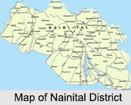
 Nainital District is one of the administrative districts of Uttarakhand. Nainital is the district headquarters. It is also the headquarter of Kumaon division of Uttarakhand.
History of Nainital District
History of Nainital District states that Nainital has several significant mythological references as Nainital is one of the 51 Shakti Peethas in India. British Government occupied Kumaon and Garhwal in 1815. On 3rd of October, 1850, Nainital Municipal Board was formally constituted. In 1862, Nainital became the summer seat of the North Western Provinces. After it was made the summer capital, a remarkable expansion of the town occurred with the growth of magnificent bungalows all around and construction of facilities such as marketing areas, rest houses, recreation centers, clubs etc together with the secretariat and other administrative units. It also became an important centre of education.
Geography of Nainital District
 Nainital District is located approximately in between 80 degree 14 minutes and 78 degree 80 minutes east longitude and 29 degree 5 minutes north latitude. To its north is Almora district and to its south lies the Udham Singh Nagar district. Champawat district flanks it in the east and district of Pauri Garhwal is in the west. On the northern side lies the Himalaya Mountain while on the southern side lies the plains making the resultant climate of the district enjoyable one. The total geographical area covered by Nainital District is 3422 sq kms.
Climate of Nainital District
Nainital District enjoys the climate of tropical, subtropical, temperate, sub alpine and alpine type. The Terai and Bhabhar belt has a moderate climate resembling with plain areas. The middle Himalayan ranges are temperate zones. Alpine zone refers to the land between the snow line and above 2000 metres and is a typical high Himalayan belt. The soil structure and texture also varies from high sandy soils having 70 percent to 80 percent sand to clay soils in which the clay percentage is up to 20 percent. In between vast tracts possess sandy loamy soils which are neither heavy nor very light.
Natural Vegetation of Nainital District
The hilly region of Nainital District is covered with Himalayan subtropical pine forests. The major trees are Oak, Buruns, Kaphal and other trees. There are small tracts of cultivated lands and fruit orchards in between the forests in this region.
Demography of Nainital District
According to the Population Census in the year 2011, Nainital District has the population of 955,128. The population density is about 225 inhabitants per square kilometers. The literacy rate of Nainital District is about 84.85 percent.
Education in Nainital District
There is a proper government educational setup in Nainital District besides having several prestigious public schools. As per survey records, there are around 1260 Junior Basic Schools, 356 Senior Basic Schools, 198 Secondary Schools, 4 degree colleges and Kumaon University. Nearly 90 percent of Junior Basic Schools are located in the rural areas while almost 85 percent and 65 percent respectively of Senior Basic and Secondary schools are located in urban areas. For technical education Nainital Polytechnic provides 3 year diploma courses in various streams like Civil, Mechanical, Electronics, Electrical and 2 year diploma courses in Pharmacy, Computer Applications, and short hand - secretarial work. Various private institutions affiliated to Kumaon University are also providing MCA, B. Ed and MBA courses.
 Culture of Nainital District
Nainital District has rich cultural traditions and heritage. The main towns of the district are cosmopolitan and its people are associated with various religions. The major part of population follows indigenous Kumaoni traditions. In societies, marriages are mostly arranged by the parents. The tradition of colorful ornamentation on Aanchal cloths is a unique Kumaoni tradition, rooted deep in its long history. The style of painting is locally known as Aipan. There are several fairs and festivals organized in Nainital District. After harvesting season people mostly relax, rejoice, dance and sing thus a festival is generated. At the transition of sun from one constellation to another Sankranti is observed. Vasant Panchami, Shivaratri, Holi, Ramnavami, Dussehra, Raksha Bandhan, Janmashtami, Diwali, etc. are some of the auspicious occasions celebrated in the district. Fairs are also organized on these occasions on certain places.
Tourism in Nainital District
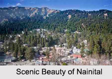
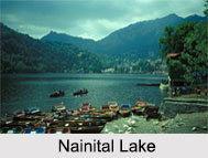
Nainital is blessed with scenic natural splendour and varied natural resources. The hilly region of Nainital District also has big and small lakes. The foothill area of the district is known as Bhabhar. The underground water level is very deep in this region. Kosi River is the main river of the district. Most of the small rivulets have been dammed for irrigation purposes. Dotted with lakes, Nainital has earned the epithet of `Lake District` of India. The most prominent of the lakes is Naini Lake ringed by hills. Nainital has a varied topography. Some of the important places in the district are Nainital, Haldwani, Kaladhungi, Ramnagar, Bhowali, Ramgarh, Mukteshwar, Bhimtal, and Naukuchiatal. Nainital`s unending scenic beauty is nothing short of a romance with awe-inspiring and pristine nature. Nainital District offers several scopes for trekking for the adventure lovers.


