 Nagaon District is one of the largest districts of Assam with its headquarters situated at Nagaon town. Lying at a distance of 123 kilometres by road from Guwahati, Nagaon town constitutes a vital corridor linking the Golaghat District, Jorhat, Sibsagar, Dibrugarh, Tinsukia District and the north Assam districts of Sonitpur and North Lakhimpur. The famous Kaziranga National Park, home of the one-horned rhinoceros, stretches from the north-eastern parts of Nagaon District up to neighbouring Golaghat District.
History of Nagaon District
History of Nagaon District can be firmly traced only from the time of the British annexation; Nagaon passed into British hands in 1826 and was declared a district in 1833. The headquarters of the district were established in Nagaon in 1839. Large portion of the Naga Hills, the Mikir Hills and North Cachar Hills were part of Nagaon District. Gradually, they were sliced away to form separate tribal district with autonomous hill councils. During the freedom struggle, freedom fighters of Nagaon district actively participated.
Geography of Nagaon District
Nagaon District is located between 25 degree 45 minutes to 26 degree 45 minutes north Latitudes. Its highlands include the Hatimura Parbat with an elevation of 186.5 metres above the sea level, the Barkandali with an altitude of 853 metres and the Kamakhya Parbat with an elevation of 244 metres above the sea level. The average altitude of Nagaon District is 60.6 metres above the sea level.
It sprawls across almost 4000 sq kilometres of fertile alluvial plains and thickly forested hills. Lakes and marshes dot the landscape of Nagaon. Brahmaputra River flows along the northern periphery of the district. Other major tributaries meandering through the district such as Kolong, Kopili and Yamuna River drain into the Brahmaputra River. In this district, weather is wet and humid. The absence of dry, hot summer and plentiful rainfall are the major characteristics of the geography of Nagaon District. The cold weather season stretches from December to February. It is followed by the pre-monsoon season of thunderstorms. January is the coldest month with temperatures varying from 10 degree Celsius to 24 degree Celsius. April and May are the warmest months.
Demography of Nagaon District
The Population Census in 2011 stated that the Nagaon district had population of 2,826,006. Out of which the male and female were 1,440,307 and 1,385,699 respectively. Nagaon District`s population constituted 9.07 percent of total population of Assam. The population density of Nagaon district for 2011 is 711 people per sq. km. Nagaon district administer 3,975 square kilometres of areas. About Sex Ratio in Nagaon, it stood at 962 per 1000 male. The average national sex ratio in India is 940 as per latest reports of Census 2011 Directorate. In 2011 Population Census, the child sex ratio of this district is 958 girls per 1000 boys.
Economy of Nagaon District
Economy of Nagaon District is purely agrarian. The major agricultural products are rice, sugarcane, mustard, jute, coconuts, bananas and vegetables. In Nagaon District, several rice and oil mills have come up over the years. The jute and sugar sector have made rapid progress. Many small scale industrial units have also developed.
Tourism in Nagaon District
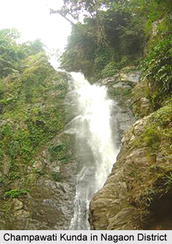
Tourist attractions of Nagaon District attract travellers from different parts of the world. Among places of interest are Batadrava, birthplace of Sankaradeva. Hojai renowned as Assam`s granary is famous for agar, an aromatic substance which is used in perfumes and is widely exported to Arab countries. Jugijan in southern Nagaon is another place of historical importance. Kaliabor, by the Kolong River, has been the scene of several critical battles of the Ahoms. Doboka, Hojai and Champawati Kunda are some other tourist attractions of this district.
Nagaon District is an old district and is the second most populated district of Assam.


