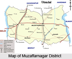
 Muzaffarnagar District is one of the 70 districts of Uttar Pradesh state in northern India and is a part of the Saharanpur division. The district headquarters of Muzaffarnagar is located in the town of Muzaffarnagar. Muzaffarnagar District is located almost 120 km from Delhi and is in the Western Region of Uttar Pradesh and is situated in the fertile Doab region of Ganga and Yamuna rivers. The district of Muzaffarnagar is conveniently connected with the rest of the country by road network and Indian railways. The district lies on National Highway- 58, Delhi to Dehradun.
History of Muzaffarnagar District
Muzaffarnagar district had experienced human civilisation since the ancient times. In Mandi village the earliest settlement, belonging to the Harappan civilization, was discovered in the district. The region also encountered the advent of Aryans from Punjab. During the periods mentioned in the Indian epics, the Ramayana and the Mahabharata, it was included in the Kuru (East) Mahajanapada territory.
The early medieval history of Muzaffarnagar district witnessed the marching of Timur`s army to Delhi through this district in 1399. During the reign of Mughal Emperor Akbar, the region of Muzaaffarnagar district was know known as Sarwat and it was conquered by Sarkar of Saharanpur. After assassinating Peer Khan Lodi (Khan Jahan Lodi), Shah Jahan conferred the title of deceased Peer Khan Lodhi and Pargana of Sarwat to Sayyid Muzaffar Ali Khan. His son Munawar Lashkar Ali founded the town and in honour of his father named it Muzaffarnagar; thus Sarwat came to be known as Muzaffarnagar.
In 1803, the British East India Company occupied the Saharanpur region, in which the current Muzaffarnagar district was included. During the rebellion against British domination in North India in 1857, the district of Muzaffarnagar became part of this revolution which is now considered as the First War of Indian Independence.

Geography of Muzaffarnagar District
Muzaffarnagar district consists of a total area of 4049 sq km and the geographical co-ordinates are between 29 degree 11`30"N and 29 degree 45`15"N and between 77 degree 3`45"E and 78 degree 7`E. the length of the district from east to west, is 97.6 km and breadth are about 85 km and 50 km respectively. The district, almost rectangular in shape, has an average elevation of 232 m.
Muzaffarnagar district is enclosed by 2 main holy rivers from 2 sides, the Ganga in the east and the Yamuna in the west. The Ganga and Yamuna rivers segregate the region from the adjacent districts of Karnal and Haryana to its west and Bijnor and Uttar Pradesh to the east. Towards the north and south of the district lie Saharanpur and Meerut districts respectively.
Demography of Muzaffarnagar District
According to the 2011 census, the population of Muzaffarnagar district is 4,138,605 and has a rank of 49th out of a total of 640 in India. The population density of the region is 1,033 inhabitants per sq km and the population growth rate over the decade 2001-2011 was 16.8 %. The gender ratio of Muzaffarnagar district is 886 females for every 1000 males, with rate of 70.11 %. The majority of population consists of Muslims along with Hindus, Christians Sikhs and Jains as well.
Economy of Muzaffarnagar District
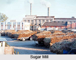
Agriculture is the main source of income for the people of Muzaffarnagar district and more than 70% of its population is engaged in cultivation and related activities. It is also an important industrial district with steel, sugar and paper being the main products. There are 11 sugar mills in the region, like Tikaula Sugar Mills and Distilleries. The market of Jaggery or Gud, in Muzaffarnagar is the largest around the globe. There are also number steel plants here like Barnala Steels, Rana Steels, Sidhbali Steels and U.P Steels etc.
Education of Muzaffarnagar District
Muzaffarnagar district is quickly developing as one of the leading educational centres of the state of Uttar Pradesh. The district consists of 2 medical colleges and 5 engineering colleges. Moreover there are a couple of management institutes and 8 degree colleges in the city. The educational infrastructure and resources have also improved a lot over the years.
Culture of Muzaffarnagar District
Muzaffarnagar district is a part of Western Uttar Pradesh and is deeply rooted in Indo-Islamic culture. There is s a certain Mughal feel present in the older parts of the region and several monuments from the Mughal period are scattered around the towns and villages of this district.
Jansath House is an old palatial bungalow located at Ansari Road. Bahoro Ka Mandir, also in Ansari Road, is a rather calm spiritual place and only a few spiritual tourists visit the temple. The temple has a unique feature and contains the eleven Shivlingas, known as Ekadash Shivalinga. Vahelna, located near the city, is a sacred place for Jains.


