 Murishidabad district is one of the 18 districts of the state of West Bengal. It has a rich historical and cultural background, and served as the last capital city of independent Bengal. Murshidabad was named after Nawab Murshid Quli Jafar Khan, the Diwan of Bengal, Bihar and Orissa and declared the capital of Bengal in 1717. It is best known for Plassey, the site of the historic battle between Nawab Siraj-Ud-Daula and Robert Clive of the East India Company which led to a British stronghold in India. The district is well known for the Silk sarees produced here, which at one time had formed one of the important exports of the English East India Company to England. The district boasts of a number of mango delicacies such as Shadulla (Himsagar), Ranipasand (favourite to the queen), Begumpasand (favourite to the Begum), Sharanga, Mulayamjam and Kohitur (the king of mangoes).
Location of Murshidabad District
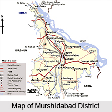
Murshidabad district is located in the state of West Bengal. It is situated between the latitudes 24 degrees 50 minutes north and 23 degrees 43 minutes north and longitudes 88 degrees 46 minutes east and 87 degrees 49 minutes east. It covers a total area of 5341 Sq. Kms. In shape, the district resembles an isosceles triangle with its apex pointing to the North-West. The Padma River flows through the entire eastern boundary, separating the district from the Malda District and Rajshahi (Bangladesh). Burdwan District and Nadia district are on the Southern side and Birbhum District and the Pakur district (Jharkhand) are on the western side of the Murshidabad district.
 History of Murshidabad District
The earliest evidences of history in the district date back to the pre-historic days perhaps as early as circa 1500 B.C. The district got its present name in the early eighteenth century and its present shape in the latter half of the eighteenth century. The district was included in the capital city of Sasanka, the great king of Gouda (comprising the most of Bengal) in the seventh century AD. Following Sasanka, his descendants from the Pala Dynasty also established their capital city in Murshidabad, including that of Mahipala, one of the later Pala kings of Bengal. The Nawab Murshid Quli Jafar Khan made Murshidabad the capital city of Sube Bangla, comprising of Bengal, Bihar and Orissa. Siraj-ud-daulah was the last sovereign ruler of Bengal who even had his capital in Murshidabad. Finally, when the British occupied Bengal, in the history of Murshidabad a new era started. The British East India Company reigned from here for many years after the Battle of Plassey and established this place as a stronghold till the transfer of the capital to Kolkata. The cultures of many races and religions such as Buddhism, Brahmanism, Vaishnavism, Jainism, Islam and Christianity have grown and been nourished in Murshidabad.
Geography of Murshidabad District
The region has been divided into two broad regions by the Bhagirathi River. These are of almost equal area, and have a marked difference in geology, agriculture, pattern of habitation and even religion practised herein.
These two areas are:
The Rarha Area - It is the plateau-like area lying to the west of the Bhagirathi River. It is substantially a continuation of the Sub-Vindhyan region of laterite clay and nodular ghuting. The land is high, slightly undulating, and interspersed with numerous swamps and beds of old rivers. The soil is greyish and reddish, rich in lime and iron oxide.

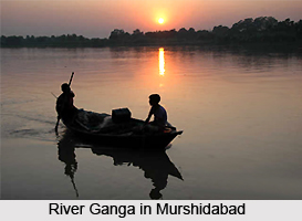
The Bagri Area - This is the area to the east of the Bhagirathi formed by Gangetic alluvial deposit. It lies between the Ganga River, Bhagirathi and Jalangi River. Since the area is low, it is exposed to annual inundations resulting in fresh silt deposits, and hence it is very fertile. A variety of crops are grown here.
The general inclination of the district west of the Baghirathi is from north - west to south - east; but in the tract east of Bhagirathi, the lines of drainage are somewhat irregular as the main rivers do not uniformly takes this direction. In the north-west of the district are some isolated clay hillocks. There is hardly any forest covering in the district. Most of the tress found here are similar to the deltaic regions of the state. There are a number of fruit trees found here, and the speciality of the district is mango. Most of the animals have been wiped out from the forests of the district. Of the ones remaining, jackals and black faced monkeys are seen. A number of species of birds, including migratory birds, are found here in the district. The water bodies attract many water birds like the dabchick / little grebe, cormorants of different types, Indian shag etc.
People in Murshidabad District
Like other parts of Bengal, there has been an inter-racial mixing in Murshidabad as well. The original inhabitants of the district are found among the Hindu and the Muslim communities. There have been immigrations in the ancient period from Northern India (Karnary and Rajputana) and Southern India (Karnat). During the Nawabi regime the Jains from Rajasthan came and settled here. Now they mostly live in the Jiaganj - Azimganj area. During the early Turkish invasions, Turk, Arab and Persian immigrants also settled here, but their numbers are few. Europeans from countries like England, France, Netherlands etc. settled here temporarily during the eighteenth century. But there are hardly any Europeans in the district now. There is a sizable number of Santhals in the Nabagram Block of Lalbagh Sub-Division.
 But they have also migrated about a hundred years ago from the neighbouring Birbhum District and other parts of the Chota Nagpur Plateau. Among other native communities Mal and Rajbansi, communities need special mention. The Chais are peculiar to this district and neighbouring Malda.
Tourism in Murshidabad District
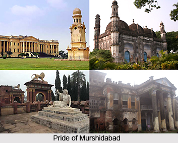
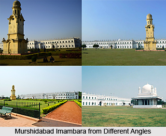
A number of places of historical note are found in the district of Murshidabad. A city of splendors and famous for its silk, it was made capital of Bengal in 1717. Plassey, where the historic battle was fought in 1757 between Nawab Siraj-Ud-Daula and Robert Clive, of the British East India Company, is only 40 Kms South of Murshidabad. The Hazarduari Palace or the palace with a thousand doors is the chief tourist attraction of Murshidabad. This three-storey palace was built in 1837 by Duncan McLeod for the Nawab Najim Humaun Jah, descendent of Mir Jafar. It has a thousand doors (among which only 900 are real) and 114 rooms and 8 galleries, built in European architectural style. It is now a museum and has an exquisite collection of armoury, splendid paintings, exhaustive portraits of the Nawabs, various works of art including beautiful works of ivory (Murshidabad School) of China (European) and many other valuables. Between the palace and the Imambara is a small mosque, `Madina`, with colourful tiled verandahs. The Mosque has an ornamented replica of Hazrat Muhammad`s tomb at Madina. Around the palace are other attractions like the Wasef Manzil (the New Palace) by the bank of the Ganga River, Tripolia Gate, the Dakshin Darwaza, the Chak Darwaza, the Imambara, the Gharighar (the Clock Tower), the Bachchawali Tope (a canon) and the Madina, the only surviving structure built by Siraj-ud-Daulah.


