 Munger District is located in the southern part of Bihar with its administrative headquarters Munger town situated on the southern bank of Ganga River. The district is spread over 1419.7 sq km accounting for 3.3 percent of the state. Munger District lies between 24 degree 22 minutes north to 25 degree 30 minutes north latitude and 85 degree 30 minutes east to 87 degree 3 minutes east longitude. Munger District is bordered by the Ganges in the north, Bhagalpur District in the east, Barh in the west and Jamui District in the south. It covers almost 14 Development Blocks. Average altitude of Munger District is 30 to 65 meters above the sea level. The administrative set-up of Munger District has three sub-divisions namely Munger, Kharagpur and Tarapur. There are nine developmental blocks namely Munger, Bariarpur, Jamalpur, Dharahara, Kharagpur, Tetia Bambar, Tarapur Asarganj and Sangrampur. There are about 903 villages in the district. Total population of Munger District as per 2001 census is 1135499, out of which male population is 604662 and female population is 530837.
History of Munger District
The existence of Munger District as a separate executive centre dates back to the year 1812. According to legends, the district derived its name from its ancient name Mudgagiri that also has a mention in Mahabharata. Munger district was the capital of the Pala Empire. Throughout the British rule, Munger was known as Monghyr. During the British rule Munger District created a portion of Bhagalpur and was made a separate district in 1832.
Geography of Munger District
 Geography of Munger District includes several hot water springs. Kiul Harohar, Dakranal and Baduar are some of the main rivers flowing through the district. Northern plain of the region has two aspects of landscape - diaras north of Gangetic levee and tal lands south of this levee. There are three main seasons in Munger District - winter, summer and monsoon. Soil of the district is suitable for cultivation.
Demography of Munger District
According to the Population Census in the year 2011, Munger District had population of 1,359,054. Out of which male and female were 723,280 and 635,774 respectively. The average literacy rate of Munger in 2011 was 73.30 compared to 59.47 of 2001. If things are looked out at gender wise, the male and female literacy were 80.06 percent and 65.53 percent respectively. The total literates in Munger District were 834,162 of which male and female were 487,096 and 347,066 respectively.
Economy of Munger District
Munger District has few industries like Gun Manufacturing Industry and ITC Limited Factory.
Tourism in Munger District
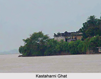
There are several tourism sites in Munger District attracting the people from various parts across the country. Some of the popular and most visited sites are Chandika Astahan, Kastaharni Ghat, Rameshwar Kund, Manpathar, Sita Kund, Sri Krishna Vatika, Bhimbandh, Malnipahar, Kharagpur Lake and more. All these tourism sites offered by Munger District are worth visiting.


