 Multi-Purpose River Valley Projects in India are those projects which try to achieve multiple targets at a time. In these kinds of projects, a gigantic single dam or a series of small dams are constructed on a river and its tributaries. The catchment areas of these dams are thoroughly afforested. This facilitates in preserving natural ecosystems and helps in conserving the flora and fauna. Afforestation helps in preventing chocking of dams, lakes, river channels and irrigation canals. This also helps in prolonging their lives. The man-made lakes created in the process help in accumulating a massive volume of rain water for checking floods and safeguarding soils. The same water becomes very useful in the irrigation of farms during the parched season, when water is in huge demand. Multi-purpose river valley projects frequently furnish for inland water navigation by rivers and canals. Another economic advantage of these projects is the perfect conditions they render for the growth of fish. The well-managed and scientifically developed river valley projects also serve as tourist destinations.
Reasons for Initiating Multi-Purpose River Valley Projects in India
Prior to Independence, water management was meant only for irrigation. But today, it encompasses creation of power, fishery in India, etc. Since the dawn of Independence, India has been engrossed in economic activities to attain self-sufficiency and improve the standard of living of its citizens. Among various actions followed for this intention, dealing with water resources has been one of the primary aims. Surface and ground water resources are looked at as complementary to each other and are considered significant for utilization. Their source is one and they attend to similar purposes. Also, floods and famines are the two of the major crisis faced in this country and as a result, they are being progressively handled in a structured fashion. Out of these practical concerns and long experiences, multi-purpose river valley projects have been gaining importance over the years. 
Multi-Purpose River Valley Projects in India
Several multi-purpose river valley projects in India have been launched. Some of these projects are described below.
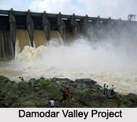
Damodar Valley Project
Damodar Valley Project was the first of its kind, adopted by free India. It comprises of a chain of small dams on the tributaries of River Damodar. This river streams from Chotanagpur in south Bihar to West Bengal, where it unites with the Hooghly. Damodar, though a small river, was called the "river of sorrow" because of the ravaging floods it used to induce. So, the principle aim of the project became the control of the flow of Damodar. The project waters about half a million hectares of land in West Bengal and parts of south-east Bihar. However, there are only a few hydel-power stations on the river. A navigable canal has also been constructed. The hydel-power is fed into a common grid in which big thermal power stations furnish majority of electricity for the maturing complexes of industries extending over south-east Bihar and bordering parts of West Bengal.
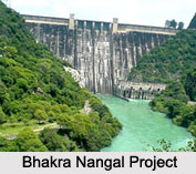
Bhakra Nangal Project
Bhakra Nangal Project comprises of the Bhakra Dam which has been erected at a calculated point, where two hills on both sides of the Satluj stand very near to each other. Due to this location, the dam is not very wide. The hills that act as huge natural walls for stashing 7, 80,000 hectare-meters of water, are made up of un-stratified matter. Being very feeble and fragile, the hills are reinforced by instilling them with enormous concrete blocks at regular periods. This dam is one of the highest gravity dams in the world. It is located in a seismic zone of India and its height reaches about 226 meters from the river bed. A part of the project, Gobind Sagar is a man-made lake in Himachal Pradesh. It has been named after Guru Govind Singh, the 10th Guru of the Sikhs. It waters a massive area of about1.4 million hectares. The Bhakra Nangal Power Plant on the Satluj creates about 1204 megawatt of electricity every year.  The project provides electricity, irrigational facilities to the states of Himachal Pradesh, Punjab, Haryana, Rajasthan and the National Capital Territory of Delhi.
Indira Gandhi Canal Project
Indira Gandhi Canal Project in Rajasthan is an aspired strategy to cover fresh areas under irrigation. The waters of the rivers namely, Beas and Ravi are channelized towards Satluj and are stored near Firozepur, Punjab, in Harike Barrage. The Pong Dam constructed on the Beas, accumulates about 6, 90,000 hectare-meters of water. It has helped to reroute the waters of Beas into Satluj in a regularized manner, so that Indira Gandhi or Rajasthan Canal, the longest irrigational canal in the world, can water Ganganagar, Bikaner and Jaisalmer districts of northwestern Rajasthan. The main canal is about 468 kilometers in length. Waters of Satluj, Beas and Ravi are being used by India to irrigate its water-thirsty lands in the north western parts of the country.
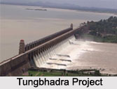
Tungbhadra Project
Tungbhadra Project is a joint venture of the Indian states of Karnataka and Andhra Pradesh on one of the tributaries of the Krishna River, the Tungbhadra. It has a prospect of irrigating about 4.97 lakh hectares of farming land. The Tungbhadra Dam, almost 50 meters high and 2.5 km long, serves multiple purposes like irrigation, electricity generation and flood control.
Other Multi-Purpose River Valley Projects in India
Some of the other Multi-Purpose River Valley Projects in India are the Chambal Valley Project, the Hirakud Project, the Kosi Project and the Nagarjun Sagar Project.


