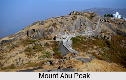
 Mount Abu Peak is the highest peak in the Aravalli Range of Rajasthan state in western India. It is located in Sirohi district. Mount Abu is 58 Km from Palanpur(Gujarat). The Mount Abu forms a distinct rocky plateau 22km long by 9 km wide. The highest peak on the mountain is Guru Shikhar, at 1722 meters above sea level. It is referred to as `an oasis in the desert`, as its elevated lands are home to rivers, lakes, waterfalls and evergreen forests. Ancient Name of Mount Abu is "Arbudaanchal". In the Puranas, Mount Abu has been said as Arbudaranya, ("forest of Arbhu") and `Abu` is a diminutive of this antique name. It is believed that sage Vasishtha retired to the southern spur at Mount Abu following his differences with sage Vishvamitra.
The town of Mount Abu, the only hill station in Rajasthan, is located at an elevation of 1220 meters. It has been a popular retreat from the heat of Rajasthan and neighbouring Gujarat for centuries. The Mount Abu Wildlife Sanctuary was established in 1960 and covers 290 Sq km of the mountain. Mount Abu boasts a number of Jain temples. The Dilwara Temples are a compound of temples, carved of white marble, that were built between the 11th and 13th centuries AD. The oldest of these temples is the Vimal Vasahi temple, built in 1031 AD by Vimal Shah and dedicated to the first of the Jain Tirthankaras. The brothers, namely Vastupal and Tejpal, who belonged to the community of Porwal Jain, built the Lun Vasahi Temple in 1231 AD. They were ministers of Raja Vir Dhawal, a local ruler of Gujarat. The Achalgarh fort, built in the 14th century by Rana Kumbha of Mewar, stands on Mount Abu. It encloses several beautiful Jain temples, including the Achaleswar Mahadev Temple (1412) and the Kantinath Temple (1513).
Nakki Lake is another popular visitor attraction at Mount Abu. There is the Toad Rock on a hill near the lake. Raghunath Temple and Maharaja Jaipur Palace are also located on hills near Nakki Lake. Mount Abu is also home to several Hindu temples, including the temple to Dattatreya built atop the Guru Shikhar peak, Adhar Devi Temple, carved out of solid rock; the Shri Raghunathji Temple and a shrine. The world headquarters of the Brahma Kumari order of lady is also located here, as is the World Spiritual University of the same denomination. There is also believed to be a footprint of Vishnu on top of Mount Abu. The Durga temple, Ambika Mata Temple lies in a fissure of rock in Jagat, just outside of Mount Abu. The nearest railway station of Mount Abu is at Abu Road, in the lowlands 27 km southeast of Mount Abu town.


